
Is There Really a 'Ban on Mining Leases' in Aravallis? Experts Debunk 5 Claims
The latest statement came after almost a week of damage‑control efforts from the Environment Ministry.
advertisement
Is the Aravalli Range at risk of losing its protected status or not?
What is the Aravallis’ total area?
How much of it is currently being mined, and how much will be opened up in the future?
These are basic yet consequential questions that the Central government should be able to answer clearly and conclusively. Instead, the Aravalli row has grown increasingly opaque and convoluted.
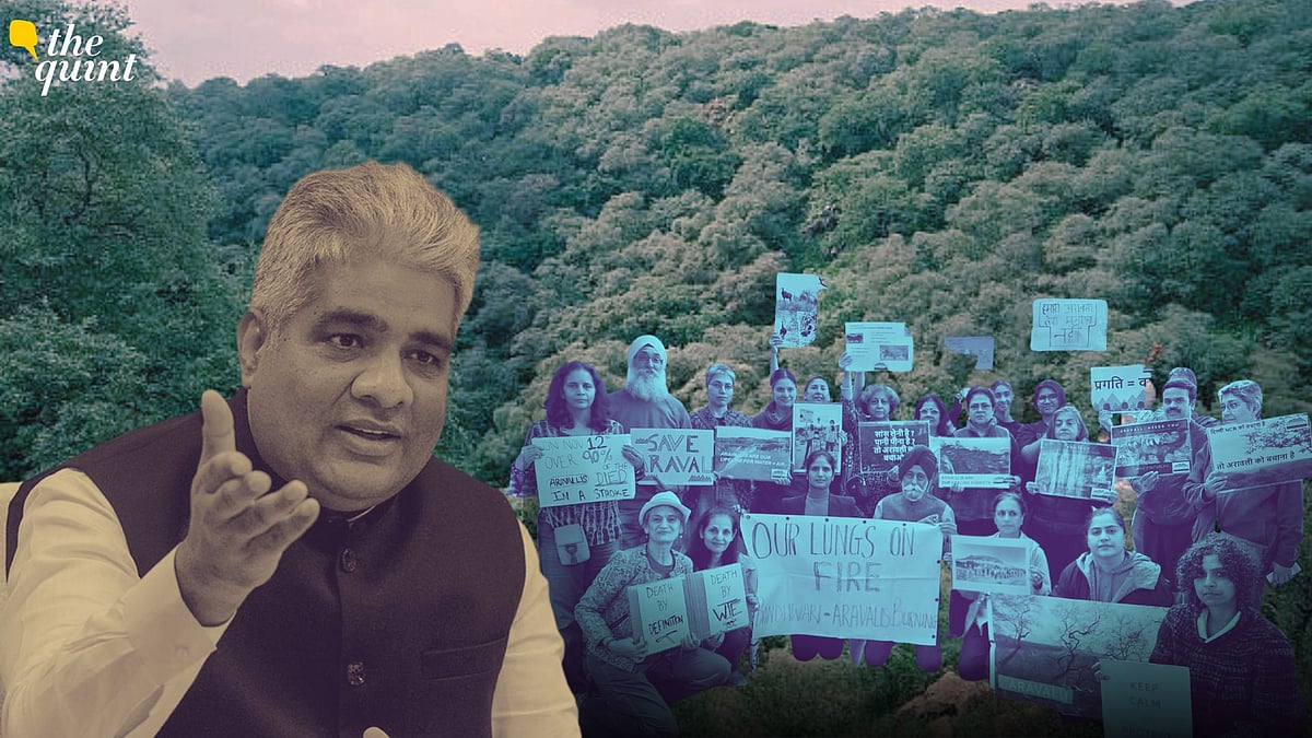
After weeks of online backlash and widespread protests over the new 100‑metre definition of the Aravalli Hills, the Ministry of Environment, Forest, and Climate Change (MoEFCC) has now said that it has issued directions to states for "a complete ban on the grant of new mining leases in the Aravallis".
The statement came after almost a week of damage‑control efforts by the ministry.
In a round of press interviews, Union Environment Minister Bhupender Yadav asserted “no relaxation (of rules) has been done in the Aravallis”
The ministry simultaneously rolled out a series of “myth vs fact” posts on its official X handle, asking followers to not be "swayed by emotions, and seek facts instead"
Claim #1: 'Ban on New Mining Leases in Entire Aravalli'
In Wednesday's press note, the Environment Ministry notes that the states are prohibited from granting any new mining leases in the Aravallis. The note then goes on to say that the ministry has directed the Indian Council of Forestry Research and Education (ICFRE) to identify additional zones across the Aravallis where mining should be prohibited, beyond areas already restricted by the Centre.
Chetan Agarwal, an independent environment and forest analyst, explains:
Further, if there is a complete ban on new mining leases, then the role of the MPSM, or the Management Plan for Sustainable Mining—to be prepared by the ICFRE—is unclear. As Neelam Ahluwalia, environmental activist and founder of the citizen-led People For Aravallis group, points out, the Supreme Court itself had already stated that the MPSM would apply to the entire geological Aravalli area, and not just to the narrowed 100-metre definition.
Although the row over the revised parameters used to define what qualifies as Aravalli Hills began in November, Agarwal adds the issue has been simmering for years.
"It was an arbitrary benchmark used by the Rajasthan and Haryana mining departments since around 2002 to free up land for mining by permitting activity in areas with local relief below 100 metres," Agarwal explains.
The Supreme Court had rejected this definition in both 2010 and 2018, even tightening restrictions on mining in the Aravalli Hills of Rajasthan in 2010. “This has been a repeated attempt over the last 15-20 years. They have now found a bench that agreed to the definition,” Agarwal says.
Claim #2: 'Total Aravalli Area is 1.44 Lakh Sq Km'
Speaking to the press last week, Environment Minister Yadav said, "The total Aravalli area is 1.44 lakh sq km. In only 217 sq km, or 2 percent of the area, there can be mining. Hills will be protected from the bottom to the top till 100 metres in height."
However, in a separate statement, the minister said “only 0.19 percent of the Aravallis is being mined,” and that the rest of the area is and will remain protected.
First, is the total Aravalli area even 1.44 lakh sq km?
As MD Sinha, former Principal Secretary and former Principal Chief Conservator of Forests, Government of Haryana, tells The Quint, the minister is "actually referring to the total geographical area of the districts where the Aravalli Range is present, and not the area of the Aravalli Range itself.”
Notably, there is no official, consolidated dataset on the total area covered by the Aravalli Range across Rajasthan, Haryana, Gujarat, and Delhi—a gap the Supreme Court has repeatedly flagged and asked the Centre to address.
A source in the Environment Ministry shared the following data with The Quint, further confirming that 1.44 lakh sq km is the combined area of the entire districts across four states in which the Aravallis are present.
(Data: Source in the MoEFCC)
Furthermore, the Forest Survey of India (FSI)’s own report submitted to the Supreme Court put the total area of Aravalli Hills in Rajasthan—the state with the largest share of the range—at 40,481.4 sq km.
As per an independent study conducted and published in the Journal Earth Science Informatics in 2022, Rajasthan accounted for nearly 80 percent of the hills. If 40.481.4 sq km make up for 80 percent of the range, the maths doesn't add up for the total area to anywhere close to 1.44 lakh sq km.
"This was the first time that the entire area had been demarcated in this way," one of the study's authors, Lakshmi Kant Sharma, who is a professor in the Department of Environmental Science at Central University of Rajasthan, Jaipur, tells The Quint.
The Aravalli range spans Rajasthan, Haryana, Delhi, and Gujarat.
(Photo source: Study - Assessment of land‑use dynamics of the Aravalli range (India) using integrated geospatial and CART approach.)
Moreover, the source in the ministry said the Aravallis spread across 20 districts in Rajasthan. But the FSI report identifies only 15 districts in the state.
Districtwise area of Aravalli Hills in Rajasthan in the FSI report.
(Data: Accessed by The Quint)
Which additional districts have been counted in Rajasthan isn't clear. “Even if a few marginal districts are added, the total area cannot increase two-and-a-half times,” says Agarwal.
“If the FSI has newer or more comprehensive data, it should be made public,” Sinha adds. “That alone would settle the controversy.”
Beyond the questions around the total area, what percent of the Aravallis is open to mining? Although the government said 2 percent, the calculation takes into account the total area of the districts instead.
"I would say this is a sleight of hand, essentially inflating the denominator to make the numerator (the percentage of area under mining) look small," says Agarwal.
Meanwhile, Sinha points out that the mining report submitted by the Rajasthan government to the Supreme Court states that they are currently mining 2,339 sq km of the Aravallis in Rajasthan, which they want to increase to 4,000 sq km.
"If you take the figure of 2,339 sq km, then Rajasthan alone is already mining in nearly 6 percent of its Aravali area. And this is just legal mining," he explains.
Submission by the state of Rajasthan in 2024 to the CEC and thereafter submitted to the Supreme Court as an annexe in the MoEFCC committee report.
(Photo: Sourced by The Quint)
Claim #3: ‘The New Definition Will Protect More Area'
During the Supreme Court hearing, the ministry had said the 100-metre definition would include a larger area under the Aravalli Range compared to the FSI’s earlier 3-degree slope formula.
The government had argued that only hill sections rising above 100 metres were protected, leaving lower areas open to mining. Under the new order, however, if a hill exceeds 100 metres, its lower portions are safeguarded as well.
However, experts say, the height-based criterion isn't more inclusive.
“If you have 10 hills and only one of them rises above 100 metres, the 100-metre rule would include just that single hill. The 3-degree slope definition, however, is a much lower threshold, which would classify almost all 10 as hills. Yet, this is exactly what the ministry’s counsel told the court, and that claim was recorded in the judgment,” explains Agarwal.
Further, the 100-metre definition doesn't take into account the ecological importance of the Aravallis.
Sharma echoes this view.
“The Aravallis are a continuous range, and their ecological and geological integrity includes the low-lying areas in between as well,” he says.
Claim #4: 'It’s Wrong to Conclude that Mining Is Permitted in All Landforms Below 100 Metres'
In a fact sheet released on Sunday, 21 December, the government clarified that any landform in the Aravalli districts rising 100 metres or more above the local relief will be classified as an Aravalli Hill. The Aravalli Range, it said, includes all landforms located within 500 metres of two adjoining hills of at least 100 metres in height. All landforms within this 500-metre zone, regardless of their height or slope, are excluded from the grant of mining leases.
"It is, therefore, wrong to conclude that mining is permitted in all landforms below 100-metre height," the statement read.
Sinha dismisses this explanation as “mere sophistry.” He argues that the first part of the definition already disqualifies a large portion of existing hills, while the second would apply only in cases where two hills over 100 metres are located within 500 metres of each other.
Claim #5: '90 Percent of the Aravallis Will Be Protected (or Excluded) Under the New Definition'
After this definition comes into action, "more than 90 percent of the Aravallis will come under protected area," Yadav told ANI in an interview.
However, a report by The Indian Express, citing sources within the FSI, said that the FSI's own internal assessment found that of the 12,081 hills measuring 20 metres or higher across 15 districts in Rajasthan, only 1,048 (or just 8.7 percent) are 100 metres or more in height, potentially leaving nearly 90 percent of these hills outside the ambit of protection under the new definition.
The FSI, however, refuted this in a post on X on 23 December, saying it had made no such assessment.
Sinha argues that the FSI's clarification raises further questions. “If the FSI is saying it hasn’t carried out an assessment yielding these results, then what assessment has it conducted? And if no such assessment exists, why hasn’t one been undertaken yet?” he asks.
Notably, the Supreme Court in its order has asked the FSI to carry out a comprehensive mapping of the Aravalli Range, including low-relief areas.
Sinha says transparency demands that the data be made public.
“If the FSI does not have these figures, on what basis did the government tell the Supreme Court that the new definition would bring more area under protection?” he further asks.
The Quint has reached out to the FSI for more details on the said assessment.
- Access to all paywalled content on site
- Ad-free experience across The Quint
- Early previews of our Special Projects
Published: undefined