(Our climate crisis special features are high on costs and resources. Please consider supporting us, so we can continue to tell stories that are important to you. Click here)
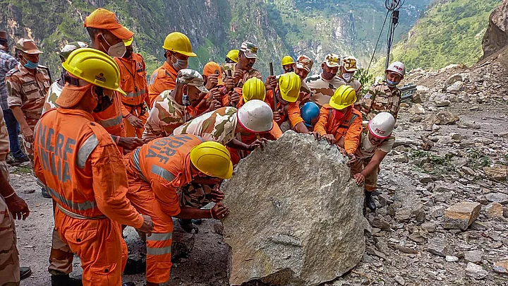
In just eight months of 2021, India has seen at least 61 landslides. Many of these like the one in Kinnaur in Himachal Pradesh, earlier this month, also saw a significant death toll, with 13 people losing their lives.
Anecdotally, the number of massive landslides, and the damage they cause, seem to have increased in India over the past couple of years. Like all extreme weather events, this too can and has been attributed to climate change.
However, unlike the mitigation for other weather events, like cyclones or floods, landslide mitigation in India faces a unique problem - that of accurate and timely prediction.
In this piece we take a look at the system of landslide predictions in India as they exist today, the challenges to these models of prediction, and the future of landslide predictions in the country.
Explainer: Landslides In India & Why They're Very Difficult To Predict
1. How Are Landslides in India Predicted Now?
The Geological Survey of India (GSI) is the nodal body in the country that works on building landslide prediction and forecasting models. Research and recommendations by the GSI are thereafter used by state and national administrative bodies to formulate mitigation strategies or evacuation strategies in landslide-prone areas.
The Quint reached out to Dr Saibal Ghosh, Director of the Landslide Studies Division of the Geohazard Research & Management (GHRM) Centre of GSI to explain the present process of landslide-mapping in India. Dr Ghosh explains that unlike floods or other disasters, the narrow geographic conditions and specifications of landslides is the main reason why they're difficult to predict.
"If you know the level of flood water, you know that anything below that flood water level will be inundated. For cyclone also, because of rain and wind systems, it is possible to know the track of the cyclone and thereby predict that along the track there will be a lot of damage," says Dr Ghosh, adding.
"But for landslides, it is very slope-specific, thereby location-specific. Therefore it is very difficult to predict exact occurrence and also time of occurrence."
At present, India has a baseline mapping model that assesses how susceptible various regions/states in the country are to landslides. Called "National Landslide Susceptibility Mapping" (NLSM), various states, and in some cases, smaller geographic divisions like districts and taluks, are divided into three zones- red, green and blue. The red zones are highly susceptible to landslides, while the green and blue zones are areas with moderate and low susceptibility respectively.
Scientists at GSI gathered data from 61,287 landslides in the last seven years to create this map, 85 percent of which is complete. Susceptibility of Arunachal Pradesh is still being assessed, following which, all of India will have a susceptibility indicator.
During this process, the GSI found that 4.34 lakh square kilometres in India - approximately 12.6 percent of its entire landmass - is susceptible to landslides.
However, Ghosh says that this is a "probability" model and not a "possibility" model. Meaning, this map gives a sense of areas that are landslide prone, but does not tell us when and exactly where a landslide will occur.
Moreover, one of the main problems with this baseline model - though a great starting point - is that there's a "scale" problem. For example, the susceptibility of an entire state may differ from the susceptibility of a particular district in that state, which will again differ from the susceptibility of a particular block or village in that district.
That apart, the susceptibility of a particular geographic area may also change over a period of time depending on factors like land-use patterns, rainfall patterns and deforestation. While the GSI updates their map based on these factors from time to time, it is difficult to do this real-time.
Expand2. Predicting Time & Exact Location of Landslides
After the susceptibility analysis has indicated which areas in India may see high occurrences of landslides, the task before the GSI is to predict when they will take place and in which exact geographical area. This would involve predicting where exactly the landslide will be initiated, and also its track and "accumulation point" i.e. where the landslide finally stops.
Dr Ghosh says that there are "early warning" models that can tackle this. The first is a "site-specific" warning model. This involves identifying the exact slope in which a landslide may take place and gathering data for that specific slope. This is a capital-intensive process whereby instruments have to placed on the exact slope and data on land-dunes, rainfall etc. for that specific slope are collected.
At present this is being done in about 8 locations in India. In the past, this exercise has been carried out in only 10 locations because of how intensive and time-consuming the process is.
The other model, which is being worked on at the moment and is expected to be a lot more efficient in predictions is a "region-specific" model. Since 2017, the GSI has been a part of an international project that is helping create this model for India.
"We have seen, based on past data, that almost 90 percent landslides in India is caused by rainfall", says Dr Ghosh. "Therefore, if we can get hold of the date of a particular landslide and the amount of rainfall in that region on that particular day, then we can predict a rainfall "threshold" beyond which a landslide is sure to take place in that area."
As of now, a prototype of this model is being implemented in the Nilgiri hills of Tamil Nadu and the Darjeeling hills of West Bengal. That apart, research work and data collection is being conducted in the states of Kerala, Uttarakhand and Arunachal Pradesh.
The prototype model was developed in 2020, and the GSI has started issuing prediction bulletins to district and disaster management authorities in the Niligiris and Darjeeling.
"This model is being used in at least 26 places in the world. However, wherever they've been able to successfully implement it, it has only been after experimenting for at least 10-12 years. In India, we don't have that kind of time", says Dr Ghosh.
The GSI has tied up with other agencies like ISRO, IMD and respective state governments to develop this model. They say that if this model is built successfully, it will largely minimize damage to human lives and livelihoods due to landsides.
Expand3. The Challenges of Early Landslide Warning
The main problem that GSI scientists are facing while developing the region-specific early warning system is lack of data.
While in some places the exact date of a previous landslide is not known, in others the rainfall data of a narrow geographical area is not available.
"It is also important to note that landslides occur in various scales. All of them are not massive. Our field officers have visited villages where a small landslide has brought down one house, but the house next to it is intact. The locals in the area were therefore not mindful of the exact date of the landslide because not much damage was caused. But if proper steps are not taken, the same area may see a landslide of a much larger scale in the coming years."
Dr Saibal Ghosh, Director, Landslide Studies Division of the Geohazard Research & Management (GHRM) Centre, Geological Survey of IndiaA discrepancy of even a day or two between the date of a landslide and the corresponding rainfall data, can throw off predictions by a huge mark.
Another factor that makes landslide predictions especially tricky is the fact that landslides are often a product of multiple weather events, which Ghosh describes as a "domino effect" that causes landslides.
For example, landslides that took place in Chamoli, Uttarakhand, earlier this year, were triggered by a glacial burst that then caused flooding and thereafter caused many landslides in the area. To predict landslides correctly, therefore, one has to also correctly predict all these other weather events.
Ultimately, however, Ghosh emphasises that the GSI and the landslide prediction models can only provide data and make a forecast. The work thereafter - that of mitigation and evacuation - has to be done by governments, especially state governments.
"One thing is clear, climate change cannot be treated as an abstract future event anymore. It is here and it is real, and if we do not act fast, lakhs of lives could be at stake", he warns.
Expand
How Are Landslides in India Predicted Now?
The Geological Survey of India (GSI) is the nodal body in the country that works on building landslide prediction and forecasting models. Research and recommendations by the GSI are thereafter used by state and national administrative bodies to formulate mitigation strategies or evacuation strategies in landslide-prone areas.
The Quint reached out to Dr Saibal Ghosh, Director of the Landslide Studies Division of the Geohazard Research & Management (GHRM) Centre of GSI to explain the present process of landslide-mapping in India. Dr Ghosh explains that unlike floods or other disasters, the narrow geographic conditions and specifications of landslides is the main reason why they're difficult to predict.
"If you know the level of flood water, you know that anything below that flood water level will be inundated. For cyclone also, because of rain and wind systems, it is possible to know the track of the cyclone and thereby predict that along the track there will be a lot of damage," says Dr Ghosh, adding.
"But for landslides, it is very slope-specific, thereby location-specific. Therefore it is very difficult to predict exact occurrence and also time of occurrence."
At present, India has a baseline mapping model that assesses how susceptible various regions/states in the country are to landslides. Called "National Landslide Susceptibility Mapping" (NLSM), various states, and in some cases, smaller geographic divisions like districts and taluks, are divided into three zones- red, green and blue. The red zones are highly susceptible to landslides, while the green and blue zones are areas with moderate and low susceptibility respectively.
Scientists at GSI gathered data from 61,287 landslides in the last seven years to create this map, 85 percent of which is complete. Susceptibility of Arunachal Pradesh is still being assessed, following which, all of India will have a susceptibility indicator.
During this process, the GSI found that 4.34 lakh square kilometres in India - approximately 12.6 percent of its entire landmass - is susceptible to landslides.
However, Ghosh says that this is a "probability" model and not a "possibility" model. Meaning, this map gives a sense of areas that are landslide prone, but does not tell us when and exactly where a landslide will occur.
Moreover, one of the main problems with this baseline model - though a great starting point - is that there's a "scale" problem. For example, the susceptibility of an entire state may differ from the susceptibility of a particular district in that state, which will again differ from the susceptibility of a particular block or village in that district.
That apart, the susceptibility of a particular geographic area may also change over a period of time depending on factors like land-use patterns, rainfall patterns and deforestation. While the GSI updates their map based on these factors from time to time, it is difficult to do this real-time.
Predicting Time & Exact Location of Landslides
After the susceptibility analysis has indicated which areas in India may see high occurrences of landslides, the task before the GSI is to predict when they will take place and in which exact geographical area. This would involve predicting where exactly the landslide will be initiated, and also its track and "accumulation point" i.e. where the landslide finally stops.
Dr Ghosh says that there are "early warning" models that can tackle this. The first is a "site-specific" warning model. This involves identifying the exact slope in which a landslide may take place and gathering data for that specific slope. This is a capital-intensive process whereby instruments have to placed on the exact slope and data on land-dunes, rainfall etc. for that specific slope are collected.
At present this is being done in about 8 locations in India. In the past, this exercise has been carried out in only 10 locations because of how intensive and time-consuming the process is.
The other model, which is being worked on at the moment and is expected to be a lot more efficient in predictions is a "region-specific" model. Since 2017, the GSI has been a part of an international project that is helping create this model for India.
"We have seen, based on past data, that almost 90 percent landslides in India is caused by rainfall", says Dr Ghosh. "Therefore, if we can get hold of the date of a particular landslide and the amount of rainfall in that region on that particular day, then we can predict a rainfall "threshold" beyond which a landslide is sure to take place in that area."
As of now, a prototype of this model is being implemented in the Nilgiri hills of Tamil Nadu and the Darjeeling hills of West Bengal. That apart, research work and data collection is being conducted in the states of Kerala, Uttarakhand and Arunachal Pradesh.
The prototype model was developed in 2020, and the GSI has started issuing prediction bulletins to district and disaster management authorities in the Niligiris and Darjeeling.
"This model is being used in at least 26 places in the world. However, wherever they've been able to successfully implement it, it has only been after experimenting for at least 10-12 years. In India, we don't have that kind of time", says Dr Ghosh.
The GSI has tied up with other agencies like ISRO, IMD and respective state governments to develop this model. They say that if this model is built successfully, it will largely minimize damage to human lives and livelihoods due to landsides.
The Challenges of Early Landslide Warning
The main problem that GSI scientists are facing while developing the region-specific early warning system is lack of data.
While in some places the exact date of a previous landslide is not known, in others the rainfall data of a narrow geographical area is not available.
"It is also important to note that landslides occur in various scales. All of them are not massive. Our field officers have visited villages where a small landslide has brought down one house, but the house next to it is intact. The locals in the area were therefore not mindful of the exact date of the landslide because not much damage was caused. But if proper steps are not taken, the same area may see a landslide of a much larger scale in the coming years."Dr Saibal Ghosh, Director, Landslide Studies Division of the Geohazard Research & Management (GHRM) Centre, Geological Survey of India
A discrepancy of even a day or two between the date of a landslide and the corresponding rainfall data, can throw off predictions by a huge mark.
Another factor that makes landslide predictions especially tricky is the fact that landslides are often a product of multiple weather events, which Ghosh describes as a "domino effect" that causes landslides.
For example, landslides that took place in Chamoli, Uttarakhand, earlier this year, were triggered by a glacial burst that then caused flooding and thereafter caused many landslides in the area. To predict landslides correctly, therefore, one has to also correctly predict all these other weather events.
Ultimately, however, Ghosh emphasises that the GSI and the landslide prediction models can only provide data and make a forecast. The work thereafter - that of mitigation and evacuation - has to be done by governments, especially state governments.
"One thing is clear, climate change cannot be treated as an abstract future event anymore. It is here and it is real, and if we do not act fast, lakhs of lives could be at stake", he warns.