
The Quint is telling the full story of how climate change is reshaping lives. Help us do more. Become a member.
A group of environmentalists and social activists has claimed that the Supreme Court-appointed High-Powered Committee, tasked with travelling the landscape and defining the Aravalli, did not visit the mining-affected villages or conduct meaningful consultations with affected communities during its field survey, as reported by PTI.
Over the six days between 6 August and 11 August, the committee visited Asola Bhatti Wildlife Sanctuary, Mangar Bani, and the Aravali Biodiversity Park in Delhi-NCR before moving into Rajasthan, according to a statement by the Aravalli Virasat Jan Abhiyaan. The committee is due to submit its report by 31 August.
This claim comes amid persistent controversy over how the Aravallis should be defined and mapped, as well as the laws that are shaped around it.
Around the same time, another number has put India’s environmental record under scrutiny. The 2026 Environmental Performance Index (EPI), developed by researchers at Yale and Columbia, ranks India 176th out of 177 countries.
While this ranking is an obvious headline, the Aravalli exercise is a more useful place to ask what environmental performance looks like when it has to be translated into law.
A Rank Worth Looking Under
The EPI assesses 177 countries across 47 indicators grouped under environmental health, ecosystem vitality, and climate change. Yale notes that EPI scores are strongly correlated with national wealth, although countries at similar income levels still perform very differently.
India’s Environment Ministry has challenged its earlier editions, including the 2022 report, over assumptions, data, and whether some indicators adequately capture national conservation efforts.
This methodological argument, however, does not make the 2026 results irrelevant.
India’s overall EPI score shows a 7.47-point improvement over its 10-year baseline. Sanitation and drinking water improved by 8.33 points, ecosystem vitality by 5.77, and the climate-change policy objective by 13.98. The country is not standing still.
But some absolute numbers remain difficult to ignore.
India ranks 174th on biodiversity and habitat, 176th on terrestrial biome protection and protected-area representativeness, and 174th on protected-area connectivity.
These are particularly relevant to the Aravalli debate because they look beyond the simple existence of protected land to questions of ecological representation and connection.
Improvement and adequacy are not the same thing. The question to ask isn't what the 176th rank “proves” about India. It is what happens when environmental ambition reaches the harder stage of deciding what exactly falls inside a protected geography.
The Problem With Drawing an Ecological Line
Environmental law needs boundaries. A regulator cannot enforce a forest law, mining restriction, or eco-sensitive zone without identifying where it applies. The difficulty is that the criteria used to draw those lines can become more consequential than they first appear.
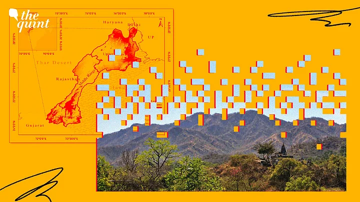
In November 2025, the Supreme Court accepted an earlier framework that treated a hill as part of the Aravallis if it rose at least 100 metres above the surrounding terrain, and treated two or more such hills within 500 metres of each other as a range.
Following that, activists and local communities raised concerns that the 100-metre threshold would exclude large parts of the Aravalli landscape from legal protection, potentially opening up ecologically sensitive areas to mining and construction.
The order was stayed the following month.
The 100-metre and 500-metre criteria are not settled law; they are precisely what the new committee is re-examining.
As a result of this, in its May order, the Supreme Court asked whether limiting an Aravalli range to hills within 500 metres of one another could create a “structural paradox” by significantly narrowing the geographical scope covered by the definition.
It also asked whether hills above the 100-metre threshold might remain part of a contiguous ecological formation even when the gap between them exceeds 500 metres.
The court was equally careful about another figure that entered the debate. It asked the committee to verify the widely reported claim that only 1,048 of Rajasthan’s 12,081 hills would meet the 100-metre threshold, rather than accepting that figure as an established scientific finding.
There is a larger issue underneath the argument over metres. Height and distance tell us something about landforms. They cannot, on their own, capture every ecological relationship across a landscape.
A lower ridge may still form part of the same drainage system as a higher one. Two formations separated by more than a prescribed distance may remain relevant to habitat movement or wider landscape integrity.
The practical challenge is to bring two geographies closer together: the geography the law can administer and the geography in which ecological processes actually take place.
That does not require abandoning measurable rules. It requires being clearer about what those rules can and cannot do.
A Threshold Cannot Do All the Work
The current field survey is instructive. Reports on the committee’s itinerary say members are assessing ecological, geological, hydrological, biodiversity, mining, land-use, and socio-economic characteristics across the landscape. Elevation is only part of the exercise.
A regulatory threshold can provide consistency. But where the environmental stakes are landscape-scale, it should sit alongside evidence on ecological function, connectivity, and cumulative impact.
A height criterion may help identify a landform without automatically answering whether lower formations around it are ecologically dispensable. A distance criterion may provide an administrable test while still requiring scrutiny of connectivity beyond that line.
This is where the EPI’s biodiversity indicators become more than background statistics.
India’s poor scores on protected-area representativeness and connectivity do not tell the Aravalli committee what definition to adopt. But, they do reflect a wider conservation concern: protecting individual patches is not enough if the ecological relationships between them are lost.
That matters in Delhi-NCR, where the Aravalli landscape contributes to groundwater recharge, habitat, and the region’s natural barrier against desertification and dust movement from the west.
Asola Bhatti and Mangar Bani cannot be understood only as isolated green parcels. Their surrounding landscape is part of the conservation question too.
The policy choice is, therefore, not between precise definitions and ecological judgement. Environmental regulation needs both.
Geological or morphological criteria can make a definition administrable.
Landscape-scale evidence can test whether applying it creates exclusions that weaken the ecological system the law is meant to protect.
Cumulative effects matter as well; several small exclusions can add up to a very different landscape.
India’s 176th EPI rank is easy to communicate. The Aravalli committee faces a less tidy task: translating a continuous, heavily altered ecological system into rules that courts, governments, and regulators can actually use.
The EPI cannot tell the committee where a ridge should legally end. But the two stories do meet at one point. Environmental governance depends not only on the decision to protect nature, but on whether the categories used for protection are capable of seeing enough of the system they are meant to govern.
For the Aravallis, that means getting the legal map closer to the ecological one.
(Khushi Singh writes on urban governance, mobility, climate, and questions of unequal access to cities and public systems. Her recent work has appeared in Down To Earth, Countercurrents, and other publications. This is an opinion piece and the views expressed are the author's own. The Quint does not endorse or is responsible for them.)
