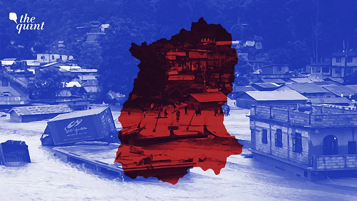
In the wee hours of Wednesday, 4 October, a 'mountain tsunami' suddenly descended on the tiny Lachen river, a tributary of the mighty Teesta river, that originates in the rarefied heights of northern Sikkim.
In the pitch blackness of the night, the massive South Lhonak glacial lake had burst.
Ice-cold water roared at an estimated speed of 15 metres/second from a height of 17,100 feet. And on its descent downhill, the water picked up thousands of tonnes of debris.
It didn't take long for the water to reach the important crossroads town of Chungthang, where the Lachen river meets the Lachung river. Here, the waters of the two rivers gushed into the 1,200 MW Teesta III hydroelectric project, which is the largest and most prestigious such project in Sikkim.
A Disaster Even Bigger Than 2013 Uttarakhand Deluge
The Teesta III dam holds water using an imposing 60 m high rock-filled concrete dam to feed its generators. The dam was breached in a flash of a second. A national infrastructure asset worth upwards of Rs 14,000 crore was gone. The water, now mixed with more debris from the shattered dam, raged downstream.
Another downstream dam, the smaller Teesta V, was severely damaged. Dozens of people were caught up in the mayhem, and the count of those missing is upwards of 100. Mercifully, Sikkim being a sparsely populated state, casualties are expected to be minimal.
The water roared towards the plains, still some distance away, snapping multiple bridges across the Teesta and severing NH10 – the highway that is a lifeline as it connects Sikkim to the rest of India.
This is the biggest disaster witnessed by the Indian Himalayas since 2013. It would not be wrong to say that it is even bigger than the 2013 Uttarakhand and 2023 Himachal Pradesh disasters.
Why Glacial Lake Outburst Floods Are Dangerous
In about four to five hours, the entire Teesta river valley had experienced one of the most dreaded geological events in the Himalayas – a Glacial Lake Outburst Flood (GLOF).
A retreating/melting glacier often creates a lake of water which is held back by loose moraine (rocks in a glacier field). When it suddenly has an outburst flood, it is called a GLOF.
Such floods release an extremely large amount of water in a short period and the water descends steeply in altitude, thus compounding its destructive power.
A GLOF packs such destructive power that the United Nations took it up several decades ago as an extreme event of concern and helps countries susceptible to these events, including India, prepare for them.
The deadliest GLOF happened in the Andes mountains of Peru in December 1941 and killed 1,800 people.
The Western, Central, and Eastern Himalayas are no strangers to a GLOF. Multiple instances of GLOFs have occurred in various scales, with the worst events happening in Tibet, Nepal, and one in Pakistan as recently as 2018.
Vulnerable regions have been identified through research across the Himalayas over the years, and high up in the list was the Lhonak lake system in northern Sikkim.
Scientists Noticed Lhonak Glacier Was Melting in 60s
Going as far back as the 1960s, scientists studying the glaciers in the Himalayas noticed that the Lhonak glacier was melting and retreating faster. Two small lakes had been born – North and South Lhonak.
The lakes steadily grew in size with South Lhonak being the bigger sibling. Every decade of monitoring gave scientists sleepless nights. The threat of a GLOF was increasing. Availability of satellite imagery from the 1990s made monitoring more frequent. The lakes were refusing to shrink.
In 2016, a desperate attempt was made by a team led by Ladakhi social worker Sonam Wangchuk to try and shrink it. They installed a siphon in South Lhonak lake to steadily drain water from it. But these efforts did not pay off as much.
While a GLOF is an extraordinary geological event, the fact that regions susceptible to it have been identified makes this an event for which warning and mitigation measures should have been in place.
The Look North-East Policy
Since the late 1990s, the 'Look North-East' policy of various central governments has looked at hydroelectric power in the Brahmaputra river system as the major infrastructure investment that will power economics in northeastern India.
That is not a bad policy, it is welcome, as access to affordable energy brings populations out of poverty and hastens speed of all-round development. But every voice that advocated treading with caution and keeping projections of expected power generation real were ignored.
Central and various state governments fell over each other trying to talk up the hydroelectric potential. At one point, the projection for Arunachal Pradesh itself was 60,000+ MW.
Sikkim wanted a few thousand MW on the Teesta river, and Bhutan, too, joined the race. Cheap money was available, and every international development-lending organisation wanted to fund these mega projects.
But sadly, everyone was missing a critical fact – of water data of rivers that form the Brahmaputra system. Till the 1980s, most of the Brahmaputra rivers – Teesta, Tawang, Siang, Subansiri, Dibang, and Lohit – were all so cut off and remote that even exploring them required massive expeditions. There were monitoring stations collecting data on the Brahmaputra before it entered its delta, but no data beyond it.
The rivers were surely massive, but to come up with projections of power generation and for projects to be financially viable in the long run, data was needed. Data collection did start by around 1990, but 10-20 years is a very short span in the life of a river. One expects at least 80-100 years of data to reliably estimate water levels.
Estimation of water levels accurately is also critical for engineering a hydroelectric project. A dam must be engineered to withstand a one-in-100-year flood. How will you do that if you have no idea what is the level of that flood from historical data? Granted, there are methods to work this out if data is not available, a project cannot wait 100 years to collect data.
But looking at multiple detailed project reports (DPR) and environmental impact assessment (EIA) of projects in Sikkim and Arunachal, this estimation was not taken seriously and studies were not conducted with rigor. This is where the added complications of GLOF and landslide-induced floods come.
Threat of GLOF Higher in Eastern Himalayas
Since the advent of satellite imaging, it has become easier to study rivers originating in Tibet and the Himalayas. The threat of GLOF as well as floods triggered by temporary lakes created by landslides began to be taken more seriously.
The threat is higher in the eastern Himalayas due to the peculiarities of its geography and geology. The Brahmaputra in Tibet, known as Yarlung Tsangpo, is vulnerable to landslide-induced floods (where a landslide blocks a river creating a big lake, which eventually bursts). Meanwhile, its tributary Teesta has a clutch of high-altitude glacial lakes ringing its origins on the India-Tibet border. There is no data available on the historical floods in these basins triggered by these factors.
Thus, projects in these areas are being engineered without solid data on extreme events. This has been pointed out by multiple scholars in Himalayan geology. The failure of Teesta III is now the 'We told you so' moment in India's recent hydropower history.
Teesta III was built with large amounts of money and human labour. It was initially budgeted to cost around Rs 5,700 crore to build, but it is estimated to have cost upwards of Rs 14,000 crore when it was commissioned in February 2017.
This kind of cost escalation is common as these projects are built by trial and error because of faulty baseline data. Look at the example of another mega project in Arunachal, the 2,000 MW Subansiri Dam – the coffer dam that enables construction of the main dam was lost for three consecutive monsoons between 2007-11 because they didn't know how much water to expect in the monsoon. Even conservative estimates expect 3x cost escalation by the time of completion of these projects.
What Concerns Were Raised During Construction of Teesta Dam?
When Teesta III was being planned, plenty of concerns were raised. Principally, locating such a big project so far upstream when threat of extreme floods was unknown.
The carrying capacity of a river becomes higher, and thus, dams become bigger as they are built downstream. This, somewhat, helps mitigate the effects of extreme events.
But when you build big so far upstream, it comes with its own challenges. Teesta III was shoe-horned into a confluence of two rivers.
Though it is technically a 'run of the river' project, it needed a storage of about 6.5 hectares backed by a 60 m rock-filled concrete dam. All the space available in the river valley was used up by storage and looks like a critical compromise was made – emergency spillways to evacuate flood water were too small.
Multiple researchers and activists have pointed out that data on spillway discharge for Teesta III has not been available even many years after it has been commissioned.
All of this has been happening while the United Nations and many geologists repeatedly have warned that the North and South Lhonak lakes pose a critical threat to the Teesta river system.
The Central Water Commission (CWC) did construct monitoring stations at multiple points many kilometres upstream of Teesta III.
They did collect data, but it looks like the warnings generated by them were too late.
Or perhaps, the volume of flood from this GLOF was simply so huge that it overwhelmed an under-engineered dam. Remote sensing data from the Indian Space Research Organisation (ISRO) estimates that South Lhonak lake lost 100+ hectares of water in the flood, while the surface area of the storage of Teesta III was roughly 6.5 hectares.
The failure of Teesta III hopefully is too big to cover up and move on. There needs to be an objective probe of how this has happened. Our country cannot afford to lose national assets that are worth thousands of crores of rupees. Extreme events such as GLOF, landslides, and cloudbursts need to be urgently considered to engineer future projects, and mitigation measures need to be incorporated in existing projects. These concerns cannot be brushed aside anymore.
(The writer is a journalist who has reported extensively in 2008-09 on hydropower projects in the Brahmaputra basin. This is an opinion piece. The views expressed above are the author’s own. The Quint neither endorses nor is responsible for them).