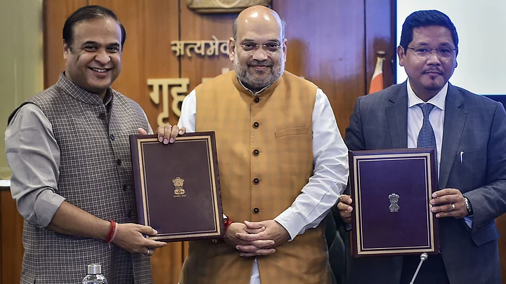
Assam Chief Minister (CM) Himanta Biswa Sarma and Meghalaya CM Conrad Sangma signed an agreement on Tuesday, 29 March, to resolve the 50-year-old inter-state border dispute between the two states.
The agreement took place in the presence of Union Home Minister Amit Shah in Delhi on Tuesday.
Sarma had earlier stated that there were 12 areas of dispute in the state of Meghalaya and that six areas have been resolved in the first phase of the resolution.
So, what was the border dispute between the two states and what has the Centre done about it? We take a look.
What Was the Border Dispute Between Assam & Meghalaya? Has the Centre Solved It?
1. History Behind Border Demarcation
During the British rule, Assam consisted of the present-day Nagaland, Arunachal Pradesh, and Meghalaya, besides Mizoram, which later became separate states.
However, the long-standing dispute between Assam and Meghalaya began in 1972 when Meghalaya was carved out of Assam under the Assam Reorganisation Act, 1971, a law that it challenged.
The two states share an 884-km-long border.
However, Meghalaya has held a different interpretation of the border since.
Expand2. Major Point of Contention
Since 1993, twelve (12) areas of differences have evolved between the two states. The said areas are: Upper Tarabari, Gazang reserve forest, Hahim, Langpih, Borduar, Boklapara, Nongwah, Matamur, Khanapara-Pilangkata, Deshdemoreah Block I and Block II, Khanduli and Retacherra.
The Langpih district in West Garo Hills, which borders the Kamrup district of Assam, is a major point of contention between Assam and Meghalaya.
During the British era, Langpih used to be a part of the Kamrup district. However, it became part of the Garo Hills and Meghalaya after independence.
Meanwhile, Assam considers it a part of the Mikir Hills in the state. However, Meghalaya has questioned Blocks I and II of the Mikir Hills (now Karbi Anglong region) being part of Assam. The state maintains that these were parts of the United Khasi and Jaintia Hills districts.
Langpih was not part of the sites named in Tuesday's agreement.
Expand3. What Were the Efforts Made in the Past and Why They Failed
In 1985, an official committee was constituted under former Supreme Court Chief Justice YV Chandrachud under then Assam Chief Minister Hiteshwar Saikia and Meghalaya Chief Minister Captain WA Sangma. The parties failed to find a solution.
According to a senior official in the Assam government, the vital difference between the efforts made by this government and the previous one was that the problem had now been "broken down to chewable bits", and the "low-hanging fruits had been identified first", reported The Indian Express.
"The six areas taken for the study did not have large differences," he told the daily, adding that the frequent meetings among the two CMs also helped. "The remaining areas of dispute are more complex," he said.
Expand4. Clashes and Controversies
Tensions erupted between the two states in August 2021 after an Assam police officer allegedly misbehaved with two men from Meghalaya in the Umlapher area in Assam's West Karbi Anglong district.
Soon, crowds gathered on both sides of the border and a Meghalaya officer was injured in the process. The situation worsened after Meghalaya residents reportedly tried to cross into Assam near Umlapher.
However, when police officers from Karbi Anglong tried to control the situation, a face-off broke out between the security officers of both states.
Earlier, former Assam Chief Minister Tarun Gogoi's government guest house had also generated controversy. Located on a small hillock in the Khanapara-Pilangakata block, Meghalaya often claimed it as part of its territory.
Expand5. Recent Actions Taken to Solve the Dispute
Over the years, around 50 high-level meetings have been held between the two states to resolve these border issues.
The first meeting between Sarma and Sangma took place in July 2021, after which another five rounds of meetings were held in the following months.
In August 2021, the governments of Assam and Meghalaya had formed a committee to resolve the border rows in a phased manner in six (6) of the 12 disputed sites (Hahim, Gizang, Tarabari, Boklapara, Khanapara-Pilingkata, Ratacherra).
Sarma had said that each panel would have five members, including a Cabinet minister of each state and bureaucrats. He also added that local representatives might be part of a committee.
Meghalaya CM Sangma had said five aspects were to be considered while resolving the disputes:
Historical evidence
Ethnicity
Administrative convenience
Mood and sentiments of the people concerned and contiguity of land
On 18 January 2022, Sarma had held a meeting with representatives of all political parties to discuss the border issue.
He had informed in a tweet, "A roadmap for amicable settlement has been prepared based on recommendations of 3 Regional Committees with representatives from both the states."
Later, the two states formed a draft resolution to resolve their border disputes in six of the 12 disputed areas.
The proposed recommendations for the 36.79 square km of land said that Assam would keep 18.51 square km, while Meghalaya would get the remaining 18.28 square km.
The Cabinets of both Assam and Meghalaya had approved the recommendations.
On 31 January, the two CMs had submitted a draft resolution to Home Minister Amit Shah for examination and consideration by the MHA.
Ahead of Tuesday's agreement signing, the two CMs reportedly had a final round of discussion with the Ministry of Home Affairs (MHA).
Expand6. How Did the Opposition React?
After the joint proposal by Assam and Meghalaya to sign the agreement last week, Opposition parties in Assam called the move "unconstitutional", adding that it effectively meant "sacrificing land" to the neighbouring hill state.
Congress' Leader of Opposition Debabrata Saikia alleged that the proposal had been submitted to Amit Shah "without even a discussion in the state Assembly".
Earlier, leaders of several Opposition parties in Assam had objected to the recommendations, saying their state was giving up more than Meghalaya. They also said that further consultations and discussions in the legislature were required.
Meanwhile, Assam CM Sarma had met the representatives of the Congress, the Communist Party of India (Marxist), the Bharatiya Janata Party (BJP), the Asom Gana Parishad (AGP), the All India United Democratic Front (AIUDF), the Bodoland People's Front (BPF), and the United People's Party Liberal (UPPL) to discuss the draft agreement.
During the meeting, Opposition parties had raised concerns over the "give-and-take" policy that had been recommended.
Sarma had also held meetings with the representatives of students' organisations, including the All Assam Students' Union (AASU), All Bodo Students' Union (ABSU), All Rabha Students' Union, All Assam Gorkha Students' Union, and Garo Students' Union.
However, in Meghalaya, the MLAs of the main Opposition party, the Trinamool Congress (TMC), weren't consulted, reported The Print.
Expand7. What is the Next Step?
The Survey of India (SoI) will delineate and demarcate the boundary in the presence of representatives of both governments. It will then go to Parliament for approval and will likely take a few months.
"Further, a survey will be done by the Survey of India with both states' involvement, and when that's done, actual demarcation will take place," Sangma told ANI.
Meanwhile, the remaining six areas are more complex and maybe a more significant challenge.
(With inputs from The Print, Firstpost, ANI and The Indian Express.)
Expand
History Behind Border Demarcation
During the British rule, Assam consisted of the present-day Nagaland, Arunachal Pradesh, and Meghalaya, besides Mizoram, which later became separate states.
However, the long-standing dispute between Assam and Meghalaya began in 1972 when Meghalaya was carved out of Assam under the Assam Reorganisation Act, 1971, a law that it challenged.
The two states share an 884-km-long border.
However, Meghalaya has held a different interpretation of the border since.
Major Point of Contention
Since 1993, twelve (12) areas of differences have evolved between the two states. The said areas are: Upper Tarabari, Gazang reserve forest, Hahim, Langpih, Borduar, Boklapara, Nongwah, Matamur, Khanapara-Pilangkata, Deshdemoreah Block I and Block II, Khanduli and Retacherra.
The Langpih district in West Garo Hills, which borders the Kamrup district of Assam, is a major point of contention between Assam and Meghalaya.
During the British era, Langpih used to be a part of the Kamrup district. However, it became part of the Garo Hills and Meghalaya after independence.
Meanwhile, Assam considers it a part of the Mikir Hills in the state. However, Meghalaya has questioned Blocks I and II of the Mikir Hills (now Karbi Anglong region) being part of Assam. The state maintains that these were parts of the United Khasi and Jaintia Hills districts.
Langpih was not part of the sites named in Tuesday's agreement.
What Were the Efforts Made in the Past and Why They Failed
In 1985, an official committee was constituted under former Supreme Court Chief Justice YV Chandrachud under then Assam Chief Minister Hiteshwar Saikia and Meghalaya Chief Minister Captain WA Sangma. The parties failed to find a solution.
According to a senior official in the Assam government, the vital difference between the efforts made by this government and the previous one was that the problem had now been "broken down to chewable bits", and the "low-hanging fruits had been identified first", reported The Indian Express.
"The six areas taken for the study did not have large differences," he told the daily, adding that the frequent meetings among the two CMs also helped. "The remaining areas of dispute are more complex," he said.
Clashes and Controversies
Tensions erupted between the two states in August 2021 after an Assam police officer allegedly misbehaved with two men from Meghalaya in the Umlapher area in Assam's West Karbi Anglong district.
Soon, crowds gathered on both sides of the border and a Meghalaya officer was injured in the process. The situation worsened after Meghalaya residents reportedly tried to cross into Assam near Umlapher.
However, when police officers from Karbi Anglong tried to control the situation, a face-off broke out between the security officers of both states.
Earlier, former Assam Chief Minister Tarun Gogoi's government guest house had also generated controversy. Located on a small hillock in the Khanapara-Pilangakata block, Meghalaya often claimed it as part of its territory.
Recent Actions Taken to Solve the Dispute
Over the years, around 50 high-level meetings have been held between the two states to resolve these border issues.
The first meeting between Sarma and Sangma took place in July 2021, after which another five rounds of meetings were held in the following months.
In August 2021, the governments of Assam and Meghalaya had formed a committee to resolve the border rows in a phased manner in six (6) of the 12 disputed sites (Hahim, Gizang, Tarabari, Boklapara, Khanapara-Pilingkata, Ratacherra).
Sarma had said that each panel would have five members, including a Cabinet minister of each state and bureaucrats. He also added that local representatives might be part of a committee.
Meghalaya CM Sangma had said five aspects were to be considered while resolving the disputes:
Historical evidence
Ethnicity
Administrative convenience
Mood and sentiments of the people concerned and contiguity of land
On 18 January 2022, Sarma had held a meeting with representatives of all political parties to discuss the border issue.
He had informed in a tweet, "A roadmap for amicable settlement has been prepared based on recommendations of 3 Regional Committees with representatives from both the states."
Later, the two states formed a draft resolution to resolve their border disputes in six of the 12 disputed areas.
The proposed recommendations for the 36.79 square km of land said that Assam would keep 18.51 square km, while Meghalaya would get the remaining 18.28 square km.
The Cabinets of both Assam and Meghalaya had approved the recommendations.
On 31 January, the two CMs had submitted a draft resolution to Home Minister Amit Shah for examination and consideration by the MHA.
Ahead of Tuesday's agreement signing, the two CMs reportedly had a final round of discussion with the Ministry of Home Affairs (MHA).
How Did the Opposition React?
After the joint proposal by Assam and Meghalaya to sign the agreement last week, Opposition parties in Assam called the move "unconstitutional", adding that it effectively meant "sacrificing land" to the neighbouring hill state.
Congress' Leader of Opposition Debabrata Saikia alleged that the proposal had been submitted to Amit Shah "without even a discussion in the state Assembly".
Earlier, leaders of several Opposition parties in Assam had objected to the recommendations, saying their state was giving up more than Meghalaya. They also said that further consultations and discussions in the legislature were required.
Meanwhile, Assam CM Sarma had met the representatives of the Congress, the Communist Party of India (Marxist), the Bharatiya Janata Party (BJP), the Asom Gana Parishad (AGP), the All India United Democratic Front (AIUDF), the Bodoland People's Front (BPF), and the United People's Party Liberal (UPPL) to discuss the draft agreement.
During the meeting, Opposition parties had raised concerns over the "give-and-take" policy that had been recommended.
Sarma had also held meetings with the representatives of students' organisations, including the All Assam Students' Union (AASU), All Bodo Students' Union (ABSU), All Rabha Students' Union, All Assam Gorkha Students' Union, and Garo Students' Union.
However, in Meghalaya, the MLAs of the main Opposition party, the Trinamool Congress (TMC), weren't consulted, reported The Print.
What is the Next Step?
The Survey of India (SoI) will delineate and demarcate the boundary in the presence of representatives of both governments. It will then go to Parliament for approval and will likely take a few months.
"Further, a survey will be done by the Survey of India with both states' involvement, and when that's done, actual demarcation will take place," Sangma told ANI.
Meanwhile, the remaining six areas are more complex and maybe a more significant challenge.
(With inputs from The Print, Firstpost, ANI and The Indian Express.)