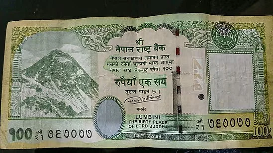
Last week, Nepal announced its decision to print newly designed 100 Nepalese rupees currency notes. The decision, according to Nepal government spokesperson and Minister of Communication Rekha Sharma, was taken on 1 May at a meeting of the Cabinet chaired by Prime Minister Pushpa Kumar Dahal.
But soon after the announcement, Nepal's decision stirred a controversy in India. The reason – the new design featured a map of Nepal that shows the territories of Lipulekh, Limpiyadhura, and Kalapani as part of the country.
So, why is that controversial? Why did Nepal decide to go ahead with its decision? And how has India reacted to this development? The Quint explains.
Why are Territories That Have Been Featured on the Map Controversial?
Nepal shares a border of over 1,850 km with five Indian states – Uttar Pradesh, Bihar, Sikkim, West Bengal, and Uttarakhand.
The three disputed areas – which cover about 370 sq km – have been under the Indian administration for a long time, but Nepal argues that, under the terms of the 1816 Treaty of Sugauli, it is her land and should be returned.
The said treaty was signed between Nepal and the East India Company – and established the boundary line of Nepal and colonial India.
However, this is not the first time that the said areas have stirred a row between the two Asian neighbours.
In May 2020, India announced a new road to Lipulekh pass in order to facilitate pilgrims visiting Kailash-Mansarovar in Tibet. Nepal had protested against it – and said that India’s decision to build the road through the territory at the Lipulekh pass, which Kathmandu claims to be part of its territory, is a breach of an agreement between the two countries.
“The Government of Nepal has learnt with regret about the ‘inauguration’ yesterday by India of ‘Link Road’ connecting to Lipu Lekh (Nepal), which passes through Nepali territory [sic]. The Government of Nepal has consistently maintained that as per the Sugauli Treaty (1816), all the territories east of Kali (Mahakali) River, including Limpiyadhura, Kalapani and Lipu Lekh, belong to Nepal," the Ministry of Foreign Affairs in Nepal had said in a statement.
Responding to this, India had asserted that the road section to Lipulekh lies within the territory of India.
"We have seen the press release dated May 9, 2020, issued by the Ministry of Foreign Affairs of Nepal pertaining to the inauguration of a road in India. The road follows the pre-existing route used by the pilgrims of the Kailash Mansarovar Yatra. Under the present project, the same road has been made pliable for the ease and convenience of pilgrims, locals and traders," a spokesperson for India’s Ministry of External Affairs had said in a press statement.
Lipulekh pass is the far western point near Kalapani. Both Nepal and India claim that Kalapani is a part of their territory. While India claims that it is a part of Uttarakhand’s Pithoragarh district, Nepal claims it that is a part of Darchula district.
Vijay Kant Karna, who is the former Nepalese ambassador to Denmark, executive chairperson of the Centre for Social Innovation and Foreign Policy (CESIF) in Nepal, and professor of political science at Tribhuvan University, explained to The Quint," In South Asian diplomacy, the Kalapani area is strategically significant. It is at the tri-junction between China, India, and Nepal. Nepal is a 'buffer state' between China and India, and thereby, both the nations have power aspirations in the region. The Kalapani dispute can have ramifications on the relations between the three."
Karna added that Kathmandu's territorial dispute with New Delhi over Lipulekh came to the limelight almost nine years ago in May 2015 when India and China agreed to develop the region for trade and transit. Kathmandu sent diplomatic notes to New Delhi and Beijing protesting against the agreement – and alleged that it would violate Nepal’s territorial integrity.
"In 2019, India released a new political map (after Prime Minister Narendra Modi came to power for a second term) showing the disputed territories within its international border. The Nepalese public protested against it and sought to amend the Constitution to include these disputed territories," he added.
"The ties between these two countries, which were strained since 2015 after India imposed an unofficial economic blockade on Nepal, went downhill further. In 2020, after Nepal protested against the building of the road to Lipulekh pass, the then Indian Army Chief General MM Naravane (retired) hinted that the objections by the Nepalese government could have been done at the 'behest of someone else'. The army chief’s comment was aimed at China, which provoked Kathmandu to raise the issue with India, which then rejected it," he added.
In response to India's actions in 2020, Nepal’s parliament issued a new political map that included the disputed area of Kalapani as well as other areas that Nepal regards as part of its territory under the terms of the 1816 Treaty of Sugauli.
In response, India took strong exception to the decision and called it "a unilateral act" – and termed the “artificial enlargement” of the territorial claims by Nepal as “untenable”.
What Nepal Said, And How India Responded
A spokesperson of the Ministry of Foreign Affairs in Nepal, who did not want to be named, told The Quint, "The decision to reintroduce the Rs 100 note with a map denoting the Nepalese territories that India claims as its own is not mean to provoke anyone."
"Kalapani, Lipulekh, and Limpiyadhura have always been a part of Nepal. We have done nothing out of the blue. We are merely doing what every other nation is doing. Every country's bank note is a symbol of the people and places it represents. Even we can raise an objection to the fact that India's Rs 100 note has the sketch of Kanchenjunga Mountain range which falls in Nepal... Here, we are not even depicting anything out of the context," the spokesperson added.
Meanwhile, External Affairs Minister S Jaishankar termed Nepal's decision to introduce a new 100 currency note featuring a map that includes disputed territories with India as "unilateral" and "untenable", PTI reported.
Jaishankar said the move "would not change the situation on the ground".
"I saw that report. I have not looked at it in detail, but I think our position is very clear. With Nepal, we were having discussions about our boundary matters through an established platform. And then in the middle of that, they unilaterally took some measures on their side. But by doing something on their side, they are not going to change the situation between us or the reality on the ground," he told reporters at an event in Bhubaneswar.
Chiranjibi Nepal, former Governor of Rastra Bank and economic advisor to President Ram Chandra Poudel, told The Indian Express that the decision by the Nepalese government has come at the "most inappropriate time and without thinking of its larger implications."
He added that Nepal being in dispute with India over certain parts of territory is one thing, but printing in the currency a map is "unwise.”