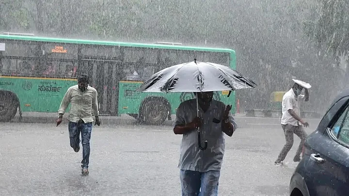
Heavy rains are expected to continue in many parts of Bengaluru, with the India Meteorological Department (IMD) forecast predicting thunderstorms and lightning with light to moderate rain on the morning of Wednesday, 18 May.
The IMD on Tuesday had issued an Orange alert for urban and rural districts of Bengaluru, predicting heavy rainfall for the next 4-5 days in the city.
Which areas are affected? Here's all you need to know.
Why is it raining heavily in Bengaluru and Karnataka?
The India Meteorological Department (IMD), in its bulletin, said that the southwest monsoon has advanced into the Andaman and Nicobar islands, signaling the start of the four-month seasonal rains.
The Andaman and Nicobar islands and adjoining areas have been experiencing rainfall due to strengthening south-westerly winds. Heavy rains are thus predicted not just in Karnataka, but parts of Tamil Nadu, Andhra Pradesh, and Kerala as well.
What are these colour-coded alerts?
According to the IMD, "colour codes are used in weather warnings for bringing out the severity of the weather phenomena expected."
These warnings are meant to caution government officials and disaster management authority to be prepared with ample resources and planning to tackle the forthcoming weather disaster.
What does each colour mean?
Red [Take Action]: It indicates severely bad weather, which can pose risk to life and can disrupt travel and power supply.
Orange [Be Prepared]: It is issued for extremely bad weather, which may cause risk to people and property. Orange alert refers to very heavy rainfall ranging from 6 cm to 20 cm.
Yellow [Be Updated]: It is used to indicate the potential impact of the upcoming weather event. A 'yellow' alert means rainfall between 6 to 11 cm.
Which are some of the worst-affected areas in Bengaluru?
Mahadevapura in Bengaluru witnessed highest rainfall in the city. The area received the highest rainfall of 155 mm between 8 am on 17 and 8 am on 18 May.
Some of the worst-affected areas are:
Mysore Road, Magadi Road, Kengeri, Nagarbhavi, Sultanpet, Old Tharagupet, Chickpet, Kalyananagar, Shanti Nagar, MG Road, Sivanchetti Gardens, JP Nagar, Jayanagar, Majestic, Yeshwantpur, and Silk Board junction.
Has the government issued any safety guidelines?
At least two people were killed in Bengaluru on Wednesday, 18 May, and several scrambled for shelter with heavy rains causing widespread waterlogging across the city, Hindustan Times reported. However, the government has not issued any safety guidelines. Stay tuned to this space for more information.
What about other parts of Karnataka?
Apart from Bengaluru, the IMD has predicted heavy rains in:
Koppal
Raichur
Uttara Kannada
Udupi
Dakshina Kannada
Ballari
Chamarajanagara
Chikkaballapur
Chikmagalur
Chitradurga
Davanagere
Hassan
Kodagu
Kolar
Mandya
Mysuru
Ramanagara
Shivamogga
Tumakuru