Cyclone Burevi to Weaken Into Depression in Next 12 Hours: IMD
Catch all the live updates on Cyclone Burevi here.
advertisement
India Meteorological Department (IMD) on Saturday, 5 December, said that the depression is likely to remain practically stationary over the same region and weaken into a well-marked low pressure area during the next 12 hours.
According to IMD, a deep depression over Gulf of Mannar is close to Ramanathapuram District is likely to move west-southwards and cross Ramanathapuram to Thoothukoodi. It is likely to weaken into a depression in the next 12 hours.
Thiruvananthapuram Airport has suspended operations from 10 am to 6 pm for Friday in the wake of the cyclone warning. Airport operations will remain open for any emergency situation, reported ANI.
- Cyclone Burevi will weaken into a depression in the next 12 hours, IMD says
- Heavy rainfall at isolated places predicted over south Coastal Andhra Pradesh and Lakshadweep on Friday, IMD warned
- Flight services at Madurai airport have been suspended till 12 pm on Friday due to Cyclone Burevi. Tuticorin airport will be closed on Friday
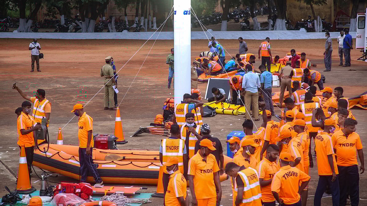
- The state government has taken precautionary steps like setting up of relief camps in Kanniyakumari and the fishermen who had gone into the sea have been informed to reach nearby shores for safety
Deep Depression to Weaken into Low Pressure Area
The IMD on Saturday said that the depression over Gulf of Mannar close to Ramanathapuram coast has remained practically stationary during the past 30 hours.
“The Depression is likely to remain practically stationary over the same region and weaken into a well-marked low pressure area during the next 12 hours,” the weather department said on Saturday.
Extremely Heavy Rainfall in TN and Puducherry
Cyclone Burevi lays over Gulf of Mannar near south Tamil Nadu coast. Wind speed is 50-60 kmph. It has remained stationary for past 12 hours. It'll further weaken into depression while moving westward across south Tamil Nadu coast during next 12 hrs, reported ANI, citing IMD DG Mrutyunjay Mohapatra
Further, the DG said:
South Kerala and North Kerala likely to receive isolated heavy to heavy rainfall today and tomorrow. As its expected to weaken, gradually wind speed will decrease to 40-50 kmph gusting to 60 kmph tonight over extreme south Tamil Nadu & South Kerala coast.
Govt Announces Helpline Numbers for Districts
The government has announced helpline numbers for districts that are likely to be affected by Cyclone Burevi.
Here is the complete list:
The 24x7 emergency number which is common for all the districts is 1077.
Emergency number in Tuticorin - 0461 2340101 and WhatsApp number 9486454714. Madurai district emergency number - landline - 0452-2546160. Tahsildar (Disaster Management) - 97888869536
Virudhunagar district emergency number - 04562 – 252600, 2526601, 262602, 252603
Ramanathapuram -04567-230056, 57, 58
Tirunelveli – Collectorate board: 0462-2501035
IMD Withdraws Red Warning Issue in Seven Kerala Districts
The India Meteorological Department (IMD) has withdrawn the red warning issued for Cyclone Burevi and rains in the seven southernmost districts of the state as the deep depression was likely to weaken further into a depression.
Puducherry: CM Narayanasamy Visits Rain-Affected Areas
Puducherry Chief Minister V Narayanasamy visited rain-affected areas in Kamaraj Nagar, reported ANI.
Heavy Rain Predicted in Tamil Nadu and Kerala Today
Heavy to very heavy rainfall is being predicted at a few places over south Tamil Nadu and at isolated places over Kerala and Mahe during next 24 hours, the IMD said in its Friday morning bulletin.
Deep Depression Over Gulf of Mannar Close to Ramanathapuram Remains Stationary
Deep Depression over Gulf of Mannar is close to Ramanathapuram District coast remained practically stationary and weaken depression for next 12 hours, about 40 km southwest of Ramanathapuram, 70 km west-southwest of Pamban: IMD
Thiruvananthapuram Airport Services Suspended
Thiruvananthapuram Airport has suspended operations from 10 am to 6 pm for Friday in the wake of the cyclone warning. Airlines advised rescheduling services as per the convenience of passengers. Airport operations will remain open for any emergency situation.
Source: ANI
Kerala Declares Public Holiday in 5 Districts
As Kerala remains on high alert, the state government has declared a public holiday for the districts of Thiruvananthapuram, Kollam, Pathanamthitta, Alappuzha and Idukki in the state for Friday.
Tamil Nadu: Wellington Dam Flows Above Highest Flood Level
On Friday, the Central Water Commission informed that Periya Odai at Venganur in Cuddalore district upstream of Wellington dam is flowing above its previous Highest Flood Level and is still rising.
Source: ANI
Flight Services from Madurai Airport Suspended
Flight services at Madurai airport have beensuspended till 12 pm on Friday, in the wake of Cyclone Burevi. Tuticorin airport to be closed on Friday.
177 People Shifted from Ponmudi Hill Station
At least 177 people were shifted from Ponmudi hill station in Trivandrum district to relief camp at Government High School in Anappara, in the wake of Cyclone Burevi, ANI reported.
Fishermen Advised Not to Venture Into Southwest Bay of Bengal
Fishermen were advised not to venture into southwest Bay of Bengal and along and off east Sri Lanka coast on Thursday, Comorin Area, Gulf of Mannar and south Tamil Nadu-Kerala and west Sri Lanka coasts from Thursday to Friday, and over Lakshadweep-Maldives area & adjoining southeast Arabian Sea from Thursday to Saturday.
Burevi Expected to Enter Kerala on Friday: Vijayan
Kerala Chief Minister Pinarayi Vijayan on Thursday said given the present set of indicators, Cyclone Burevi is expected to enter Kerala on Friday.
“According to the IMD, Burevi is expected to enter Indian territory at Tuticorin coast either tonight (Thursday) or tomorrow morning (Friday). By tomorrow afternoon, it is expected to touch base in Kerala... it is expected to arrive in the Kollam and Thiruvananthapuram border and from there, it will go into the Arabian Sea. Once in land the expected maximum wind speed is expected to be 60 kms in an hour,” he said.
Vijayan said that districts like Pathanamthitta, Idukki and Alappuzha can expect very heavy rainfall.
“All have to be very cautious and have to be on alert till it leaves our state. All the basic arrangements have been done and officials are also ready. Mobile operators have been asked to ensure that they provide generators at all tower sites. Air Force and Navy are also all ready, in case a need arises,” he added.