Script and Editorial Inputs: Abhilash Mallick and Kritika Goel
Video Editor: Abhishek Sharma
Camera: Athar Rather
Geolocation is a key fact-checking technique that fact-checkers around the world use on a regular basis. To explain it simply, geolocation is all about looking for clues in the photographs and videos to find out where exactly they were captured.
People who spread misinformation or disinformation often take videos and photos from a different place and share it with a misleading claim to create a false narrative. In that case, fact-checkers first find the location of the image and then check the claim shared with it.
In this episode of 'Verify Kiya Kya?', we will tell you about the tools that you can use to find the location where a piece of content was created.
Fact-checkers use a combination of satellite map imagery, user-generated content and street view images available on platforms like Google Maps, Bing Maps, Mapillary, Yandex, Open street map, etc.
Some of the clues fact-checkers look out for are shop signs, landmarks, the style of buildings, logos, and street signs. Other elements in the video that also help in geolocating a video are the language used in the video, vehicle registration numbers, and even flags.
We will use Google Maps to explain how to geolocate an image. But before using that, you will have to get used to using the Satellite View and Street View options on Google Maps.
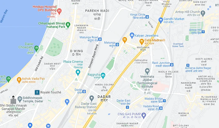
Satellite View: Shows images from a top-view, taken by satellites
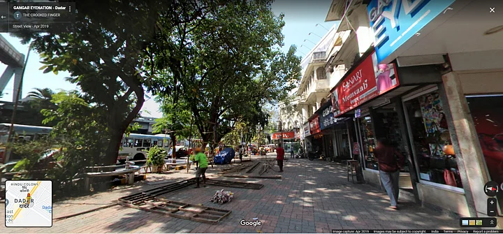
Street View: Shows images from the street level, taken by users/Google
How To Turn On Street View?
When we first look at the map of any location, we are shown the default map view (traffic) of the area. We can then toggle between different detailed views or switch to the satellite view.
Google Street View is a technology featured in Google Maps and Google Earth, which provides panoramic views from positions along many streets in the world.
When you look for a location on Google Maps, you will see a small yellow figure at the bottom right corner of the window.
- 01/03
The satellite view of the city.
(Source: Google/Screenshot)

- 02/03
Street view activated using the yellow figure.
(Source: Google/Screenshot)
- 03/03
Example of street view in the city.
(Source: Google/Screenshot)
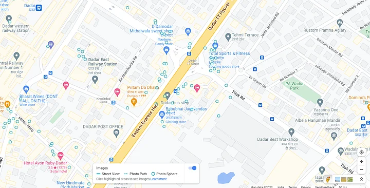
When you click on this figure or drag and drop it on the map, you will see the map light up with blue lines and dots. Those dots are the available street view images.
For example, let’s look at the streets around Eiffel Tower in Paris.
Using Google Maps to Fact-Check a Claim
Now, let's look at an example. When the Bihar Assembly elections were about to begin in 2021, an old image of street graffiti saying 'Modi Go Back' was shared with the false claim that it’s an image from Bihar, showing the public's disapproval of Prime Minister Narendra Modi.
But we found that the image was from January 2020, when PM Modi visited West Bengal and anti-CAA protests broke out in Kolkata’s Esplanade area, and here's how.
A reverse image search led us to the original image shared by journalist Mayukh Ranjan Ghosh on 11 January 2020. The caption of the image clearly stated that the photograph was from Kolkata.
We then looked for other clues in the viral image and noticed the text on a building in the background that read “Metro Channel Control Post Hare Street Police Station.”
A keyword search on Google Maps revealed that the location is indeed in Kolkata. Images on Google Maps were also similar to the building in the viral image.
Some of you keen observers might have already noticed the yellow taxi and blue and white markings on the railings and guessed that the image was from Kolkata.
Thus, using Google Maps, we were able to geolocate the image to Kolkata and, in the process, debunk the claim that it was taken in Bihar.
(This is the sixth video of a series titled 'Verify Kiya Kya?' exploring the nuances of fact-checking and media literacy. In the next video, we will talk about how should you talk to your relatives, who keep forwarding misinformation. Stay tuned!)
(Not convinced of a post or information you came across online and want it verified? Send us the details on WhatsApp at 9643651818, or e-mail it to us at webqoof@thequint.com and we'll fact-check it for you. You can also read all our fact-checked stories here.)