
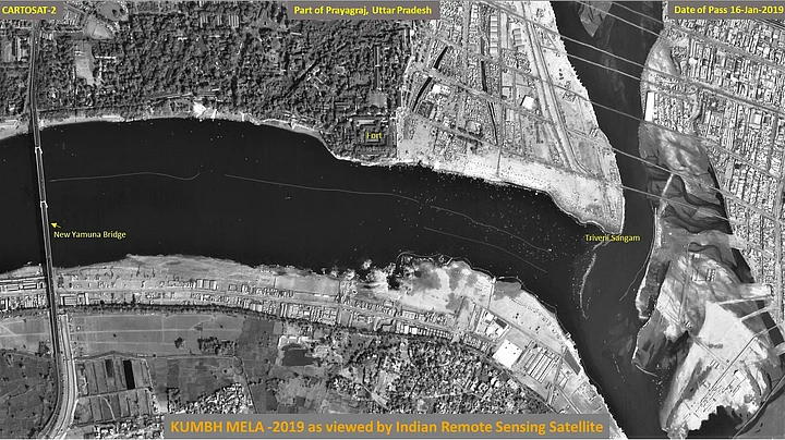
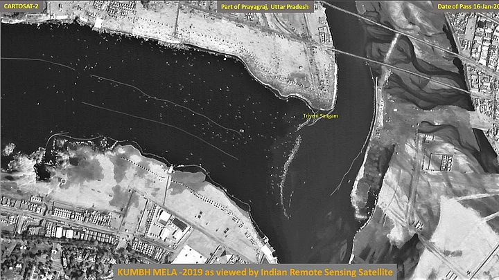
Indian Space Research Organisation (ISRO) on Thursday, 17 January, released two satellite images of the key areas of the ongoing Kumbh Mela in Uttar Pradesh's Prayagraj.
The images were released by ISRO's Cartosat-2 series satellite that was launched on-board PSLV-C40 on 12 Janaury 2018. The images show the ‘in and around’ areas of the Kumbh Mela. The black-and-white images mark the key areas of the Allahabad Fort, Triveni Sangam and the New Yamuna Bridge.
The Kumbh Mela, one of the largest religious gatherings in the world, saw more than two crore devotees attending the event and taking Shahi Snan (holy dip) at the Triveni Sangam – the confluence of the Ganga and Yamuna rivers and the mythical Saraswati.
The 49-day-long mega event that commenced on 15 January, is sprawled across a 45-km area. The UP government also announced a budget of approximately Rs 2,800 crore for the event, making it one of the most expensive religious congregations in the state.
This is the second time ISRO released photos from its Cartosat-2 satellite, claims a Times of India report.