The government on Saturday, 2 November, issued a notification specifying the newly marked boundaries of the Union Territories of Jammu and Kashmir and Ladakh. The notification results in a new political map of India.
The development comes two days after the erstwhile state of Jammu and Kashmir was officially bifurcated into the two UTs.
Following the bifurcation, India now has 28 states and nine Union Territories.
Here’s the new political map of India:
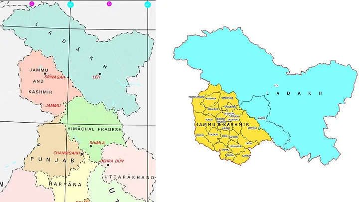
According to the notification, the UT of Ladakh will comprise the territories of Kargil and Leh districts, while all the other districts of the erstwhile state will fall under the UT of Jammu and Kashmir.
Here’s the map for the two newly-formed UTs:
The bifurcation of the state also marked the end of President's rule imposed in the undivided Jammu and Kashmir.
(This is a developing story. More details awaited)