
In what could prove to be an embarrassment to the National Council of Educational Research and Training (NCERT), a Class 12 Political Science textbook shows Aksai Chin as part of China with the label ‘Indian claim’.
The textbook – titled ‘Contemporary World Politics’ – was first printed in 2007 and subsequently reprinted. It contains a map showing Aksai Chin coloured in the same yellow as China. The map is “Courtesy of the University of Texas, libraries. The University of Texas at Austin”. It’s been used to explain the South East Asian region as an alternative power centre.
The Quint has reached out to NCERT for a comment and will update this article when it is received.
Penalties for Misrepresentation
Ironically, it was to prevent such ‘misrepresentation’ of India’s map that the Central Government last year proposed the Geospatial Information Regulation Bill, 2016 providing for a fine that could range from Rs 10 lakh to Rs 100 crore and/or imprisonment for a period of up to seven years. Under its ambit is wrongful depiction, dissemination, publication or distribution of any wrong or false topographic information of India including international boundaries through internet platforms or online services or in any electronic or physical form.
The bill came under heavy scrutiny and has now been taken down from the Ministry of Home Affairs website, where it was originally published.
Until the new bill comes into force, the rules of mapping India are governed by The Criminal Law Amendment Act of 1961.
The Act governs against cartography “questioning the territorial integrity or frontiers of India in a manner prejudicial to the interests of safety and security of India.” It clearly prescribes that “whoever publishes a map of India, which is not in conformity with the maps of India as published by the Survey of India, shall be punishable with imprisonment which may be extended to six months, or with fine, or with both.”
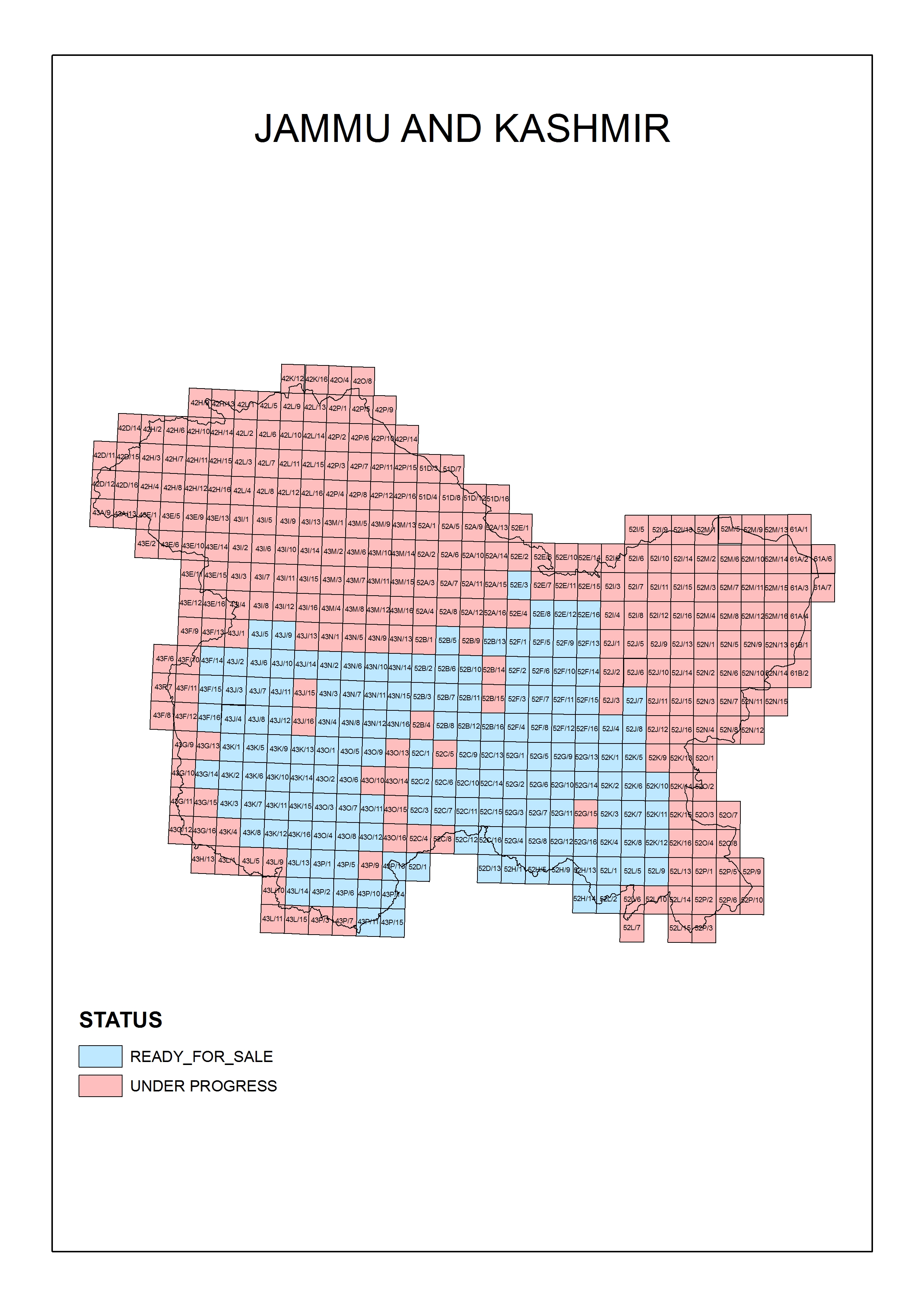
The public view of the map of Jammu and Kashmir is ‘restricted’ on the Survey of India website, which otherwise is the apex government body entrusted with map preparation and distribution. This means that applications have to be made for the map.
Interestingly, SoI does have a map of J&K showing the availability of district maps of the state.
The territories that are under dispute with China and Pakistan are coloured red and marked as ‘Under Progress.’ The maps of rest of the state are however available for sale.
What is Aksai Chin’s Significance?
The Indian claim to Aksai Chin was based on an internal British Indian survey, the Johnson Line. After the Sino-India war of 1962 resulted in a humiliating defeat for India, the Chinese declared a unilateral ceasefire, withdrawing from Arunachal Pradesh – but not Aksai Chin.
China’s retention of what may seem an inhospitable desert while giving up the fertile cherry that dropped into its mouth was a very shrewd move. In the words of Chairman Mao Zedong, China could see beyond its nose.
Aksai Chin has since become the dragon’s bargaining chip, keeping India militarily insecure and engaged.
India has continued to call Chinese administration of the region “illegal occupation,” and the Indian version of the map marks it under the Ladakh district of the state of Jammu and Kashmir.
The case is similar to the Gilgit-Baltistan region, which is under the unlawful control of Pakistan. Both these regions are integral to any official Indian map and generate public outrage if not correctly represented.
It remains to be seen how the fiercely nationalist Indian government will deal with its own institution’s oversight. After all, what greater tool of propaganda than education, influencing impressionable minds?
(Akshat Tyagi is the author of ‘Naked Emperor of Education’, India's first young voice against the dehumanising schooling model. He regularly writes on education, society, and politics. He can be reached at akshattyagi.com. This is a contributory news report. The Quint has put out the story as a matter of public interest and doesn’t endorse the map as produced in the NCERT textbook.)