
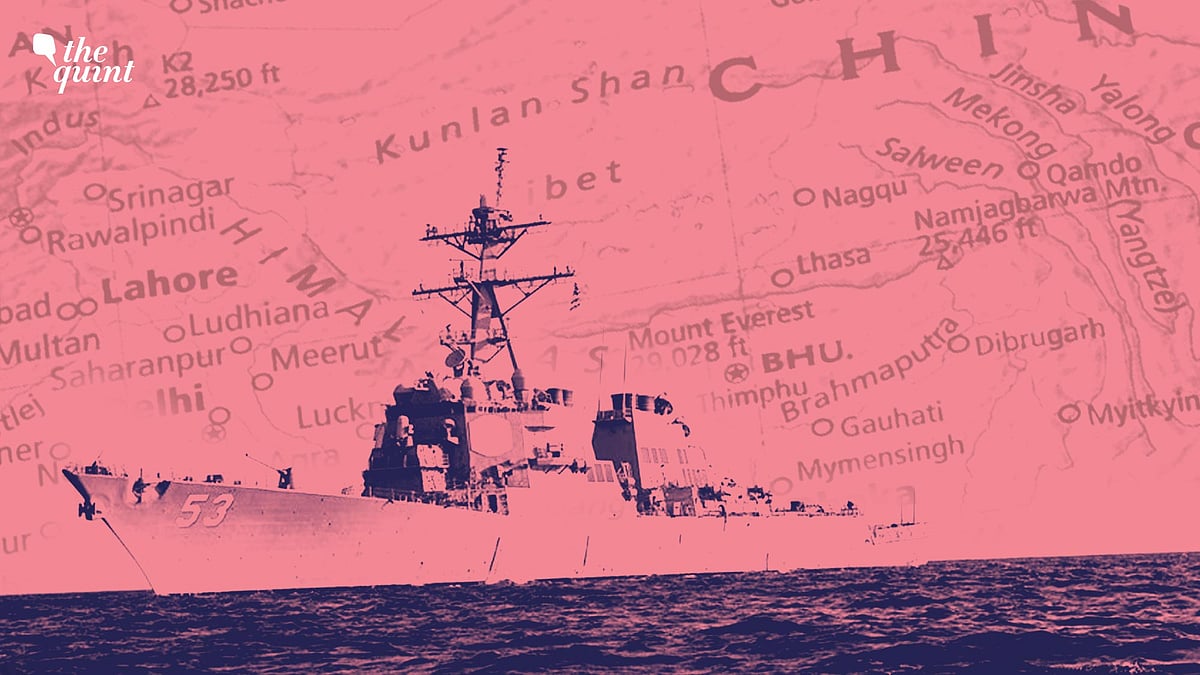
What US Warship’s Lakshadweep Sail Means for India & China
The message to New Delhi is that the Biden administration makes no exceptions to rules-based international order.
advertisement
The US action in sailing the destroyer John Paul Jones past the Lakshdweep islands has got India’s normally hawkish strategic commentariat in a tizzy. Having advocated marching lockstep with the US to deal with the Chinese encroachments into the “rules-based international order”, they are aghast at Washington questioning their own commitments to some of those rules.
Make no mistake that the action was a signal both to China and India.
On the other hand, the message to New Delhi is that when the Biden administration talks of rules based international order, it makes no exceptions, the rules apply equally to all.
There is another hidden message we also need to explore in relation to Indian maritime claims around the Lakshdweep Islands.
UNCLOS & India’s Policy of Prior Notification
Not surprisingly, the Ministry of External Affairs issued a mealy-mouthed statement merely re-stating India’s 1995 declaration at the time of ratifying the UNCLOS.
It does not amount to any change in the law, but merely states that it “does not authorse other states… to carry out military exercises of maneuvers in India’s EEZ or continental shelf”.
The value of these categories differ in the case of islands, rocks, and low tide elevations. Islands follow the same 12+24+200 nm formula. Rocks have 12 nm territorial sea and a 24 nm contiguous zone, but no EEZ and low tide elevations generate nothing.
Under UNCLOS, war vessels can transit through another state’s territorial waters in what is called “peaceful passage”, with its weapons radars and system turned off. But in the contiguous zone or the EEZ, which are international waters, there is no restriction on military exercises and maneuvers.
Under domestic law India requires prior notification for all these activities and the Chinese go a step further and demand prior permission for these actions.
US – The Lord of the Seas
The US says the Indian, and for that matter, the Chinese position, is “inconsistent with international law.” So, Washington, which has itself yet to ratify the UNCLOS, has decided to uphold “the rights, freedoms and lawful uses of the sea” recognised by the law.
- Last year, according to an official release, it challenged 28 different “excessive maritime claims by 19 different claimants throughout the world,” and it has been doing this for decades.
- The US conducts what it calls Freedom of Navigation Operations (FONOPS) since 1979, but the earliest record we have with regard to India is of 1992, when it sent a warship to enter our 12 mile nautical mile territorial sea to challenge our requirement that the US inform us before doing so.
- This time around, fortunately, they were some 130 nm west of the Lakshadweep. And this is itself another 200 nm from the Kerala coast.
A 2016 listing by the office of the US Judge Advocate General reveals the various excessive claims that the US accuses India of making. Besides the issue of prior notification for entering India’s territorial seas and EEZ, is the issue of straight baselines.
It has made it clear that it objects to India’s claim that the waters of Palk Bay and Gulf of Mannar, till the boundary with Sri Lanka, are historic waters formed by straight baselines. The US does not recognise this and conducted FONOPS there in 1993, 1994 and 1999.
Is US Challenging India’s Baseline ‘Violation’?
What is perhaps more worrisome is the possibility that the US FONOP near Lakshadweep islands relates to prior notification, which as we noted, they have been doing so regularly in the past, or whether they have come up with a new challenge. This could relate to the 2009 Indian decision to declare straight baselines to enclose the entire group of Lakshdweep islands.
- Baselines are points at the edge of the land at low tide from which territorial sea, contiguous zone and EEZ are measured outwards to the sea.
- UNCLOS allows archipelagic states like Indonesia and the Philippines to draw straight lines between two basepoints of islands that may be spread out, thus entitling them to claim territoriality over waters enclosed, even if they do not fit the 12+24+200 formula.
But as we said, only archipelagic states have this privilege, not continental states like India and China, which may happen to also have island chains.
But even now, we do not know if the US has challenged our straight baselines in the Lakshdweep. While in the case of China, which has done the same thing with the Paracel Islands group, US in 2016 sent in the USS Decatur into the island group where it loitered within the islands, however, ensuring that it did not cross the 12nm limit of any individual island.
Why India Wants to Safeguard Lakshadweep
The challenge in Lakshadweep is fraught. The islands lie at a very strategically sensitive part of the country. Ships in great numbers from the Persian Gulf and the Suez Canal go to East Asia in sea lanes on either side of the Lakshdweep islands.
To the immediate south of Lakshdweep lies Maldives, which had just some years ago, decided to build a joint observation station with China on its western Makunudhoo island and leased some islands to the Chinese.
Only the navy of a powerful country like the US would dare to challenge India on that point and what the recent FONOP tells us is that, at the end of the day, what matters in international law is power.
The US today has the ability to conduct such operations around the world and even the second most powerful navy cannot stop them in the western Pacific. We, on the other hand, can chase away a Chinese survey ship from the Andamans, as we did a while ago, but taking on the US on the issue is not an option.
China’s navy is steadily accruing power, in its own region, as well as the Indian Ocean where it is allied to Pakistan. The US example could well provide it with an opportunity to stir up trouble along our coast, on the pretext of challenging our so-called “excessive maritime claims”.
(The writer is Distinguished Fellow, Observer Research Foundation, New Delhi. This is an opinion piece. The views expressed above are the author’s own. The Quint neither endorses nor is responsible for them.)
- Access to all paywalled content on site
- Ad-free experience across The Quint
- Early previews of our Special Projects
Published: 11 Apr 2021,11:40 AM IST