How 3D Thermal Sensing Can Detect COVID-19 Cases in Public Spaces
Cron Systems has combined LIDAR sensing and AI to track individuals with high temperature in large spaces.
advertisement
What was once science fiction is slowly becoming reality in the times we live in. How do you track people running a high temperature in a public space, who could be potential coronavirus carriers?
While most public spaces will have thermal temperature scanners at the entrance as standard practice soon, it is still difficult to screen all individuals.
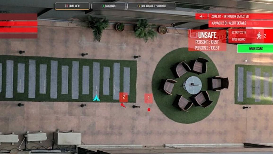
Now an Indian deep-tech company, Cron Systems, has invented an artificial intelligence platform that uses thermal sensing cameras coupled with LIDAR (light detection and ranging sensors from Quanergy) to be able to scan large public spaces and detect people with high temperature.
Here's how the system works.
Public spaces will have thermal sensing cameras that will constantly be scanning the crowd. People who have temperatures below 99 degrees Fahrenheit (98.6F is average normal body temperature) will appear as green dots to the system. Those with higher temperatures will appear red.
The data from these 3D thermal sensing cameras with LIDARs is sent to Innovace, which is an AI-enabled software box, that can interpret the data from the LIDARs on to a map of the area to track movement.
Once it detects people with high temperatures, the individual's movement is constantly tracked within the zone and it can sound an alarm if needed if the individual is found to be within a few feet of a healthy person.
Cron Systems CEO Tushar Chhabra says the Innovace software and SenseEdge AI platform makes mapping in a large area easier and it can be integrated with multiple cameras.
The system is meant to be deployed at airports, malls and hotels. It is an enterprise solution and costs about USD 3,500 to cover a 50 sq metres area (548 square feet).