How Did the Flash Floods Unfold in Sikkim? ISRO's Satellite Images Explain
Take a look at the temporal satellite images captured by ISRO's radar satellite RISAT 1A.
advertisement
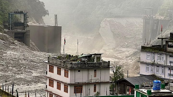
Devastating flash floods hit the northeastern state of Sikkim on Wednesday, 5 October, with at least 14 people dead and over 100 more missing.
But what exactly triggered the floods? The National Remote Sensing Centre, a unit of the Indian Space Research Organisation (ISRO), conducted a satellite-based study on the 'Outburst of the South Lhonak Lake' in Sikkim.
Here's what the ISRO study reveals.
These satellite images depict the South Lhonak Lake area to be around 162.7 Hectares on 17 September, and 167.4 Hectares approximately, at 6 pm on 28 September.
(Photo Courtesy: ISRO)
It also shows the lake area at around 60.3 Hectares approximately, at 6 am on 4 October.
(Photo Courtesy: ISRO)
The country's space agency added that it will continue monitoring the lake by further using satellite data.
'A Combination of Rainfall & GLOF': NDMA
Meanwhile, the National Disaster Management Authority (NDMA) has also provided a brief explanation: "In the early hours of Wednesday, there was a sudden surge in water flow in the Teesta river, which washed away several bridges, parts of NH-10, the Chungthang Dam and has impacted several small villages, towns and infrastructure projects in the upper reaches of the river valley."
"The primary reason for sudden surge appears to be a likely combination of excess rainfall and the Glacial Lake Outburst Flood (GLOF) event at the South Lhonak Lake in North Sikkim," it added.