In Photos: In Search of the Invisible McMahon Line
It was an arduous journey through inaccessible roads in -5° C without mobile network and sometimes electricity.
advertisement
The 73-day Doklam standoff between India and China significantly changed operations at the border. The Indian Army for instance, decided to ramp up the road infrastructure along the border to ensure swift movements of troops when necessity beckons.
By the end of December 2017, when it was reported that China was constructing a road at Bishing village in Arunachal Pradesh’s Tuting area in the Upper Siang district, the Chinese road construction machines rolled almost 1.25 km inside the imaginary Line of Actual Control or the Mc Mohan Line.
This obviously did not go down well with the Indo Tibetan Border Police (ITBP) who eventually had to step in and thwart off the Chinese construction workers.
So I decided to visit the Indo-China border rather the McMahon Line to comprehend the ground reality. The journey was long and arduous through inaccessible roads in -5 degrees Celsius without mobile network and sometimes without even electricity.
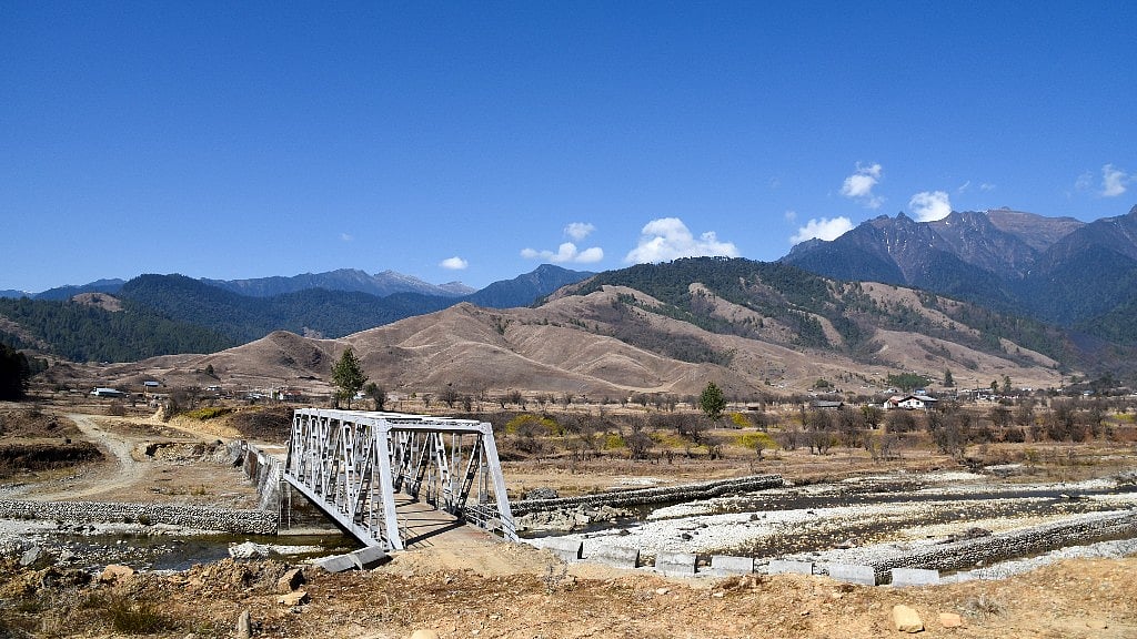
From the mainland, I set out to India’s last village Mechuka in the West Siang district of Arunachal Pradesh. Mechuka holds a historic importance since it was strategic locations during the India-China war in 1962.
Situated 6,000 feet above the sea level, this hilly and meandering route from McMahon line to Mechuka was one of the entry points of the People's Liberation Army (PLA) in 1962 and it had reportedly reached a place called Tato village which is only 150 km from the Along.
But now it’s fast becoming a popular tourist attraction for the adventurous nature-lovers. It is also home to around 7,000 natives of the Memba tribe.
This little valley is 29 km from the McMahon line, but travelling through road gets complicated with the area being permanently covered under snow throughout the year. Lamang is the last Indian post from the imaginary McMahon line, which usually requires one day of trek.
A local porter explained that the PLA usually comes to inspect the McMahon line every two weeks. But the Indian Army is not taking any chances, especially after an incident two years ago when the PLA had crossed the border at Chuningla.
Unfortunately, my journey didn’t go exactly as planned. I made it only as far Yorllung, which is 26 km from Mechuka. Close to Yorllung is another Memba populated village called Lhaung, which used to be closely associated with Sang village in Tibet. But with the army building roads and putting checks, the intimacy between the two villages have come to a halt.
As 78-year-old Sangi Lama of Lhaung told me: “We live in an isolated country, in previous years when we are not under the India government we used to have business relations with Sang. We exported green chillis, wheat and imported salt and dairy products from them. In 1962 when China attacked India they took help from those Tibetan people to communicate with us because we have many cultural similarities.”
The Indian government started army deployment at this border in 1985. Like Lhaung, another village, Segong – the last village on the Indian side – is facing restrictions of movement since the India army started ramping up their presence.
Te Yang, a villager from Segong said, “Lamang is the last point of Indian territory. But ITBP put a check gate at Yorllung which is 14 km before Lamang. If we want to cross the check gate we have to take permission from the ITBP office. Nowadays, the Indian Army put another check gate before Yorllung to control movement of villager those go to take firewoods and hunt animals.”
Sometimes, entire villages are vacated for a few hours for the routine mock drills. “The government should allow us to use and live in our own land, why are they restricting us because they are afraid of Chinese troops?” he asked.
Pasang Sona, social worker based in Mechuka, said that the villagers are working with the Indian Army everyday to protect the land, but the villagers are losing out on livelihood opportunities.
“We are working with BRO... Local villagers work with troops as porter and patrol international boundary. Tourism should be promoted here but government is imposing rules regarding restriction of movement,” Sona told me.
The one spot that was opened for tourists in 2009 is Lake Pasang Sonam Tso. Even the government spent lakhs of rupees on it, but recently, the Indian Army put in a check gate before Yorllung effectively imposing a hurdle for tourists.
“If you want to go to the lake you have to take permission from Additional Deputy Commissioner, Mechuka and ITBP. We had several meeting with officials regarding removal of this check gate but Army officials said this lake situated close to international border so they can’t give access to tourist,” Sona complained.
“At least tourists can visit Kashmir, even the media can reports from there, but government isn’t allowing anyone in Arunachal Pradesh to report on border issues,” Pasang Sona said voicing disappointment.
My journey came to an end just 1 kilometer before Yorllung at the Indian army’s Kumayon regiment camp — the exact point which the villagers complained about. They refused my access and they said, “You will not go further this point because these are sensitive zone.” Even my identity proof and Inner Line Permit seemed insufficient to be allowed to go beyond. I’m asked for ADC Mechuka’s permission letter along with that of ITBP. Unfortunately I had neither.
(Tanmoy Bhaduri, an award winning photojournalist based in Kolkata, India. He covers breaking news stories and under-reported issues on development, women and child rights, human trafficking, insurgencies, natural disaster, tribal affairs, climate change, land rights, strikes and conflicts.)