‘Have Not Revised Boundary’: MEA on Nepal’s Objections to New Map
The Nepalese government says the Kalapani area lies within Nepalese territory, their Foreign Ministry said.
advertisement
Responding to Nepal’s objection that the Kalapani area has been shown as part of India’s territory in the new political map, the Ministry of External Affairs (MEA), on Thursday, 7 November, said that the new map “has in no way revised India’s boundary with Nepal.”
The Nepal government on Wednesday made it clear that the Kalapani area situated in the country's far West lies within the Nepalese boundary, days after India issued new political maps reportedly showing the region as part of its territory.
The MEA, in a statement said,
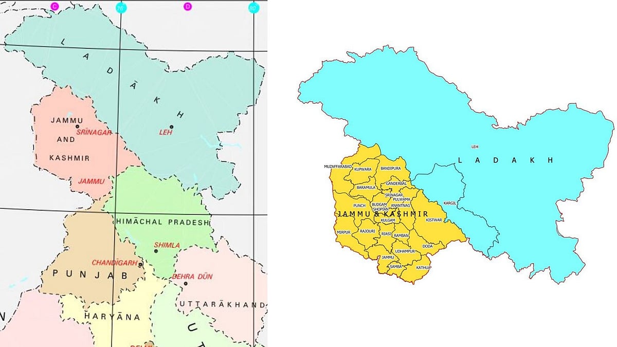
India on Saturday, 2 November, had released fresh maps of the newly created Union Territories (UTs) of Jammu and Kashmir and Ladakh, and the map of India depicting these new UTs.
In the maps, Pakistan-occupied Kashmir is part of the newly created Union Territory of Jammu and Kashmir, while Gilgit-Baltistan is in the Union Territory of Ladakh.
The Nepalese government has said that media reports drew its attention to the Kalapani area being included in India’s new map.
"During foreign secretary-level joint meetings, responsibility has been assigned to the foreign secretaries of both the countries to resolve the remaining border-related issues between Nepal and India in consultation with concerned technicians," it said in a statement, PTI reported.
All the outstanding issues relating to the border between the two countries need to be resolved through mutual understanding and any unilateral move is unacceptable to the Nepal government, the ministry said.
Indian embassy officials in Kathmandu were not immediately available for comment.
A report in Nepalese local media said Kalapani was a part of the Darchula district of Nepal while the Indian map places it under the Pithoragarh district in Uttarakhand.
When contacted, Nepalese Undersecretary at the Ministry of Foreign Affairs Suresh Adhikari said that the ministry was trying to find out the truth.
“Map meant for demarcation of international boundary should be sketched in a larger scale,” he said.
(With inputs from PTI)