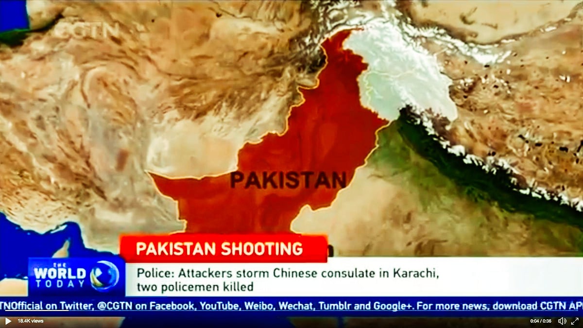
Chinese TV Shows Pakistan-Occupied Kashmir as Part of India
The map was used by China’s state-run television channel while showing an attack on Chinese consulate in Karachi.

advertisement
China’s international news channel CGTN, in its recent television telecast, has shown the disputed territory of Pakistan-occupied Kashmir (PoK) as part of India.
The map used in the telecast has demarcated Pakistan from India and the area marked as Pakistan in the map does not include PoK.
The map was used by China’s state-run television channel while showing an attack on the Chinese consulate in Karachi on Friday, 23 November.
The repercussions of this move haven’t been ascertained yet, reported The Economic Times. The report further stated that the map used by the channel could trigger a response from Islamabad or Pakistan Army.
According to the report, showing the entire state of Jammu and Kashmir as part of India will have implications for the China-Pakistan-Economic-Corridor (CPEC), as India has strong reservations with respect to the corridor.