Viral Photo of Map of India Shows Wrong Boundaries of J&K, Ladakh
A viral photo of the political map of India claims to be India’s new map post the bifurcation of J&K.
advertisement
CLAIM
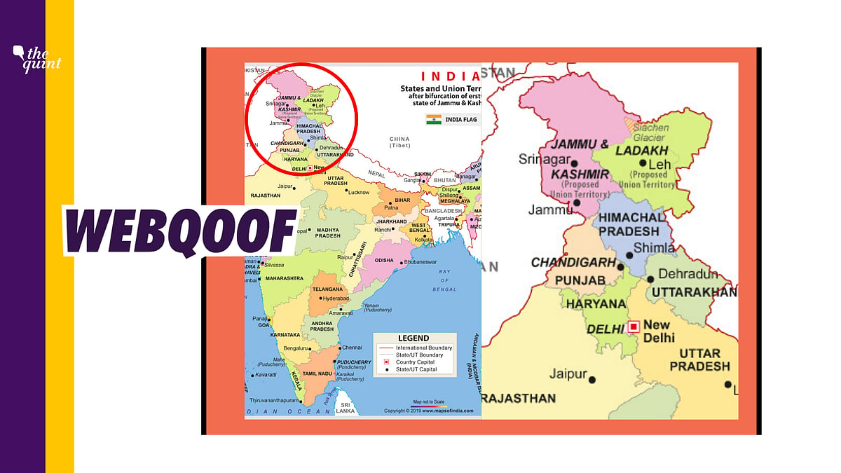
A picture of the political map of India is viral on social media, claiming to be India’s new map post the bifurcation of Jammu & Kashmir. The picture shows the updated boundaries of Jammu & Kashmir and Ladakh, with roughly equal areas allotted to the two new Union Territories.
The picture was posted with the caption “New Map India”.
Many people shared this photo of the map on Twitter and Facebook.
WHAT IS THE CONTEXT?
On 5 August 2019, the Government of India revoked Article 370 of the Constitution, that gave special status to the residents of Jammu & Kashmir. The government also decided to bifurcate the state of Jammu & Kashmir into two UTs — J&K and Ladakh —which came into effect on 31 October 2019.
TRUE OR FALSE
The picture which claims to be the new political map of India is fake. The picture shows that the two UTs of J&K and Ladakh have been assigned roughly equal areas, which is incorrect.
WHAT WE FOUND
On 2 November 2019, the Government of India released photos of the new political map of India. The new map released by the government showed Ladakh with a larger area in comparison to Jammu & Kashmir.
Multiple news outlets, including The Quint, carried reports about the new map of India showing the boundaries of the two newly created Union Territories.
A map showing just the two UTs of J&K and Ladakh was also released by the Government of India.
Press Information Bureau tweeted out a number of photos of the new political map of India on 2 November, two days after the bifurcation came into effect on 31 October.
Therefore, we can see that the photo of the map of India which is viral is actually fake and shows incorrect bifurcation of J&K and Ladakh.
(Not convinced of a post or information you came across online and want it verified? Send us the details on Whatsapp at 9643651818, or e-mail it to us at webqoof@thequint.com and we'll fact-check it for you. You can also read all our fact-checked stories here)