Kerala Floods: NASA Shares Distressing “Before” and “After” Images
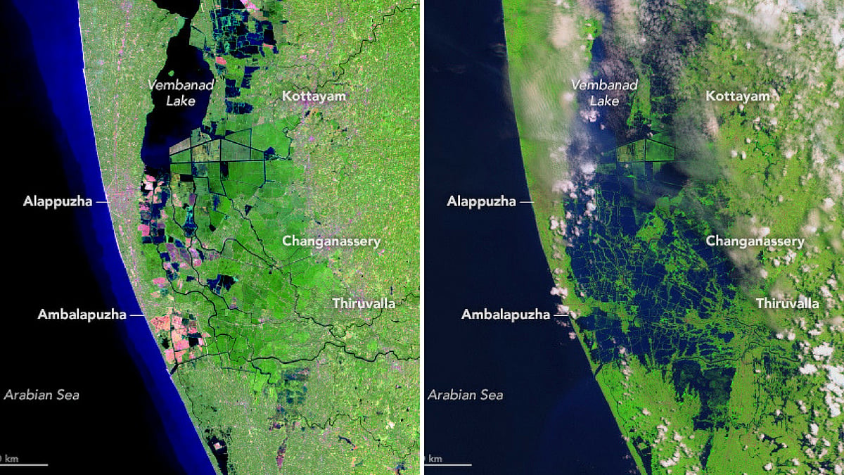
The first image was taken in February 2018, while the second image in August after the floods.
advertisement
It only took two photographs shared by the National Aeronautics and Space Agency (NASA) to reaffirm nationwide speculations about the extent of damage that the recent floods caused in Kerala.
One satellite image was taken on 6 February using the Operational Land Imager (OLI) on the Landsat 8 satellite. This image shows a green landmass denoting vegetation, and surrounded by water bodies.
The second satellite image was clicked on 22 August by the Multispectral instrument on the European Space Agency's Sentinel-2 satellite. This image, on the other hand, shows a 2.2km stretch submerged under water from the Karuvannur River and various rivers having spilled on to the landmass around them. As reported by NASA Earth Observatory, the image also depicts elevated water levels along the Periyar river that displaced thousands of people.
The images were rendered using false-color, so that the vegetation may appear bright green and the flood water may appear dark blue.