Indonesia Hit by 7.4-Magnitude Earthquake: 1 Dead, Tsunami Alert Issued
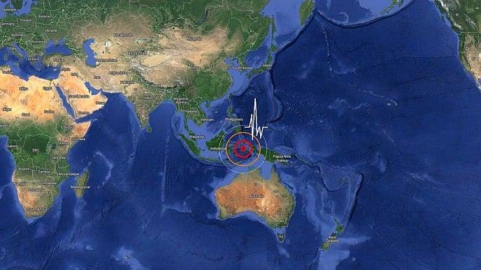
The epicentre was located approximately 127 kilometres west-northwest of Ternate at a depth of 35 kilometres.
advertisement
A magnitude 7.4 earthquake struck the Molucca Sea region of Indonesia early on 2 April 2026. The quake’s epicentre was located approximately 127 kilometres west-northwest of Ternate at a depth of 35 kilometres.
Tsunami warnings were issued for coastal areas, and small tsunami waves were recorded at several monitoring stations.
The Indonesian Search and Rescue Agency reported that a 70-year-old woman died in North Sulawesi’s Minahasa district, and another resident sustained injuries.
Reporting indicated that the fatality occurred in Manado, North Sulawesi, when a building collapsed.
According to The Guardian, the United States Geological Survey initially recorded the earthquake at a magnitude of 7.8 before revising it to 7.4.
The US tsunami warning system indicated that tsunami waves between 0.3 and 1 metres above tide level were possible along parts of the Indonesian coastline, with smaller waves forecast for neighbouring countries.
As reported by Deccan Herald, Indonesia’s meteorology agency BMKG confirmed tsunami waves in five locations, with the highest recorded at 0.75 metres in North Minahasa, North Sulawesi.
Authorities monitored 11 aftershocks, the largest measuring 5.5 in magnitude, and urged the public to remain vigilant for further seismic activity.
Coverage revealed that the Pacific Tsunami Warning Center issued alerts for hazardous tsunami waves within a 1,000-kilometre radius of the epicentre, affecting Indonesia, the Philippines, and Malaysia.
The warning was later lifted after assessments showed no ongoing threat to distant regions.
Initial assessments indicated that the earthquake caused light to moderate damage in Ternate, including to a church and several houses, while in Bitung, damage evaluations were ongoing as details emerged.
“At this stage, caution is still required, particularly for communities living along the coast,” Disaster Management Agency spokesperson Abdul Muhari stated, urging residents not to return to beaches until authorities declared the area safe.
“We had just woken up and suddenly the earthquake hit... we all ran out of the house. The shaking was very strong,” said Bitung resident Marten Mandagi, describing the immediate aftermath.
Indonesia’s location on the Pacific “Ring of Fire” makes it highly susceptible to seismic activity, with frequent earthquakes and volcanic eruptions as historical data shows. The authorities continue to advise vigilance in coastal communities and are conducting ongoing assessments of structural damage and aftershock risks.
Note: This article is produced using AI-assisted tools and is based on publicly available information. It has been reviewed by The Quint's editorial team before publishing.