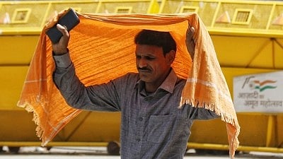
At 31.6°C, Delhi Sees Hottest February Day; Temperatures to Rise Further
This marked the earliest instance in five years that the city’s temperature crossed the 30°C threshold in February.
advertisement
Delhi experienced an unusually hot day in mid-February, with the maximum temperature reaching 31.6°C at the Safdarjung observatory.
This marked the earliest instance in five years that the city’s temperature crossed the 30°C threshold in February.
The temperature was recorded as seven degrees above the seasonal average, and other observatories across the city also reported significantly higher-than-normal daytime temperatures.
According to Hindustan Times, the last time Delhi saw temperatures above 30°C this early in February was in 2021, when the maximum reached 30.4°C on 11 February.
The current year’s spike is attributed to a lack of significant rainfall and persistent clear skies, which have allowed for uninterrupted sunshine and a steady rise in temperatures.
As noted in an article by Hindustan Times, the India Meteorological Department (IMD) reported that the Safdarjung observatory’s maximum temperature was 7.2°C above normal, with a sharp 24-hour increase of 3.1°C.
Other stations, such as Ayanagar, recorded 30.4°C, which is 7.1°C above the average, while Lodi Road and Ridge also reported temperatures well above their respective seasonal norms.
Coverage revealed that the average maximum temperature for the first half of February was 25°C, nearly 1.9°C above the long-term average. The minimum temperature on the day the record was set was 10.1°C, which is a degree below normal, indicating a significant diurnal variation.
Weather experts explained that the absence of rain and low moisture levels have contributed to the clear skies and bright sunshine, resulting in the rapid temperature increase.
Analysis showed that all five major reporting stations in Delhi—Safdarjung, Palam, Lodi Road, Ridge, and Ayanagar—recorded zero rainfall in the 24-hour period leading up to the temperature spike.
“Mercury is on the rise as we have not seen any significant rain or enough moisture to lead to cloudiness. In the absence of that, we are witnessing clear skies and bright sunshine,” an IMD official was quoted as saying by the Hindustan Times.
Forecasts indicate that the maximum temperature is expected to remain high, with only marginal relief anticipated from a weak western disturbance that may bring light rain and gusty winds.
Reporting indicated that the maximum temperature could temporarily dip to 26-28°C, but is likely to rise again towards the weekend, potentially touching 30°C once more by Sunday.
Delhi’s air quality remained in the ‘poor’ category during this period, with the average Air Quality Index (AQI) settling at 258. Further details showed that the minimum temperatures at various stations ranged from slightly above to below normal, with Ayanagar recording a low of 9.4°C, which is 1.5°C below the seasonal average.
“This is going to continue for the next one to two days, and then there is a slight chance of scattered rain in the capital due to the approaching western disturbance. Until then, the minimum temperature is also going to rise,” said Mahesh Palawat, Vice-President at Skymet.
Historical data shows that while February 2025 and 2023 were also warmer than average, the current year’s early temperature surge is notable for its timing and intensity.
Forecasts suggested that the dip in temperature due to the western disturbance would be temporary, with a return to higher temperatures expected soon after.
Note: This article is produced using AI-assisted tools and is based on publicly available information. It has been reviewed by The Quint's editorial team before publishing.